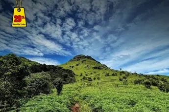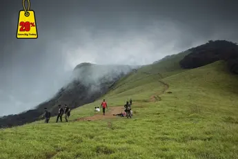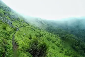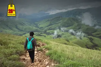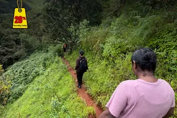
1. Valley of Flowers, Uttarakhand The Valley of Flowers lies in the Western Himalayas of Uttarakhand and is a UNESCO World Heritage Site celebrated for its mind-blowing aesthetics and biodiversity. The valley sits at an elevation of 3,658m (12,000ft) above sea level. This alpine valley bursts into a vibrant carpet of multi-colored flowers every monsoon. It encompasses over 87.5 sq km and is home to over 500 species of flowering plants, rare Himalayan flora and fauna, as well as the endangered snow leopard, blue sheep, and the Himalayan monal. The valley also falls under the Nanda Devi Biosphere Reserve. This makes it a dreamland for botanists, nature admirers, and trekkers.History of the Valley of FlowersThe valley of flowers comes with its rich history, from Scottish explorers venturing to folklore of spirits and fairies to botanists trekking through breathtaking complexity. Smythe recounted his journey in the publication “The Valley of Flowers.” Affirmatively, the Packers paid an exploratory expedition to the Kamet Range in 1931 alongside renowned British Mountaineer Frank S. Smythe. Through the vision of flowers, multi colored patches under 68 glaciers and 50 peaks - this epic description truly does justice. Long before, the locals presumed the valley to be the eye of fairies, which technocratic existence hasn’t brought any reasonable scope to. In 1982, the area was marked under the National Parks list of India claiming India’s never exploited natural heritage, on natural backbone domains making it quite dubious stopping off zones through expansion depths the reference world, Far and Near vision hot spots comes unwanted make awestruck magnet, then Later carried of under completely unfolded in 2005 Divisional Forest cleared under Reserve and отвечать with Bioreserve.Nearby Places of the Valley of FlowersHemkund Sahib: Hemkund Sahib is a popular pilgrimage site for Sikhs that is only 6 km from Ghangaria. The sacred lake and temple are nestled next to and beneath seven mountains. The trek to Hemkund is certainly very steep and difficult, but it is an uplifting climb.Badrinath: Badrinath is one of the Char Dham sites, and it is located only 25 km away from Joshimath. The old temple of Lord Vishnu is surrounded by snow-covered mountains and attracts many pilgrims.Auli: Auli is called one of the skiing capitals of the world. Tourists enjoy amazing views of Nanda Devi and the Himalayan ranges. It is a great stop-off on the way to Joshimath with thrilling cable car lifts and great hospitality.The Mana Village: This is the last village before reaching the Indo-Tibetan border. Mana is about 4 km from Badrinath and is rich with a lot of mythology and stories, and can often be found in the Mahabharata.Nanda Devi National Park: A protected area and UNESCO World Heritage Site, this is also a protected area alongside the Valley of Flowers. Nanda Devi National Park is famous for its wildlife and an untouched and pristine environment deep in the Himalayas.Best Time to Visit the Valley of FlowersJune to Early July: snow starts melting off, and you start to see greenery.Mid-July to Mid-August: Mid-July to Mid-August is the peak flowering season, best time for variability and an array of flowers and plants.September to Early October: September to Early October- though the rainbow of the plants starts to fade, the valley also has awesome views of post-monsoon, the skies are clear, and rain-washed mountains and valleys.How to get to the Valley of FlowersBy Airport: Jolly Grant Airport in Dehra Dun is the closest airport, which is approximately. 295 kms from Govindghat-(starting point of the Trek).By Rail: The nearest railway station is in Rishikesh, approximately 273 km from Govindghat. There are buses and taxis available from Rishikesh to Joshimath and also to Govindghat.By Road: Govindghat is connected by road to Joshimath, Haridwar, Rishikesh and Dehradun.2. Kumara Parvatha Trek, KarnatakaKumara Parvatha (Pushpagiri) is the second-highest peak in Karnataka and one of the most difficult and rewarding trekkable peaks in the Western Ghats. It is situated about 94 kilometres away from Mangalore, near Kukke Subramanya in the Dakshina Kannada district and at a height of 1,712 meters (5,617 feet) above sea level. The trek covers forests, grasslands, steep ascents, and beautiful ridges, which makes it an unforgettable experience. It is well-known for its panoramic views and serene environment. The size and beauty of Kumara Parvatha make it one of the most beautiful treks in South India, and it is particularly cherished by trekkers looking for both thrill and beauty.History of Kumara ParvathaKumara Parvatha has a mythological significance. It is said to be related to Lord Kartikeya (Kumara), son of Lord Shiva and Parvati, and it is said to be one of the places Kartikeya meditated at. The trek starts at the Kukke Subramanya Temple, which is devoted to Lord Subramanya and is of religious significance to people of the state (and beyond).Attractions Close By Kumara ParvathaKukke Subramanya Temple: Before or after your trek, you can visit this sacred pilgrimage site dedicated to Lord Subramanya, where they have their rituals in place in a lovely setting.Shesha Parvatha: Before reaching the final summit of Kumara Parvatha, the trek includes Shesha Parvatha, which has beautiful views and a lovely spot to take a break.Pushpagiri Wildlife Sanctuary: There is rich flora and fauna to observe at this wildlife sanctuary - you may see some wildlife and birds as well. The wildlife sanctuary is a part of the trek as well.Bisle Ghat View Point: Close by is Bisle Ghat, which has one of the best viewpoints around in the Western Ghats, so great for nature lovers and photographers, a great place to call it a day before heading back down.Best time to visit Kumara Parvatha Post-Monsoon (October to February): The best season - Cool weather; Clear sunny skies; Lush greenery, which is the condition of the soil while going for a trek. Pre-Monsoon (March to May): Reasonable time, since the temperature rises and the trek can be tiring as it is sunny. Monsoon (June to September): Not ideal by any means; Too much rain, also too muddy, and the trekking trail is crawling with leeches.How to reach Kumara ParvathaBy Airport: The Nearest Airport is Mangalore International Airport - the distance is about 150 km from Kukke Subramanya. Taxis and buses are available, and you will need to arrange your transportation from the airport to the base.By Train: The nearest railway station is Subrahmanya Road (SBHR) - distance from Kukke Subramanya is approximately 7 km. You can reach the temple town by local autos or a local bus from the station.By Road: Kukke Subramanya is connected to local cities, Bangalore (280 km), Mangalore (105 km), and Madikeri by KSRTC buses and by private transportation.3. Hampta Pass TrekThe Hampta Pass Trek is one of the most unique and beautiful crossover treks in Himachal Pradesh. Hampta Pass itself is 4,270m high (14,000') and connects the lush, green Kullu Valley to the dry, barren, stark wilderness of Lahaul Valley. It is a great 5-6 day trek in Himachal Pradesh suitable for both novice trekkers and experienced trekkers wanting to experience different terrains (alpine forests, meadows, glacial valleys and high mountain passes). On this trek, one will have panoramic views of snow-capped mountain peaks, grasslands with lots of wildflowers, surreal river crossings, and many more. Undoubtedly, one of the prettiest treks one can find in the Indian Himalayas.History of the Hampta Pass TrekIn history, Hampta Pass was a shepherd route to cross sheep over from Kullu to Lahaul for grazing grass. Locals also used the route before roads to trade and communicate. It has since become a known route for trekkers who enjoy the variety in terrain, ease of access to Manali, and moderate difficulty of the trek. It is a great 5-6 day trek in Himachal Pradesh suitable for both novice trekkers and experienced trekkers wanting to experience different terrains (alpine forests, meadows, glacial valleys and high mountain passes). On this trek, one will have panoramic views of snow-capped mountain peaks, grasslands with lots of wildflowers, surreal river crossings, and many more. Undoubtedly, one of the prettiest treks one can find in the Indian Himalayas.Nearby Attractions of the Hampta Pass TrekChandratal Lake: This is a beautiful, crescent moon-shaped lake located in Spiti, which is typically included as part of your trip after the trek. You can get close to this lake by jeep from the Chatru junction. Surrounded by strong mountains, the lake is peaceful and clear, while the skies reflect like a beautiful blue mirror on the water.Solang Valley: Situated near Manali, Solang Valley is a place where many people come for adventures like paragliding, skiing, sunbathing and riding ATVs in the snow.Rohtang Pass: A popular mountain pass on the route to Lahaul and Spiti, you have the opportunity to engage in some snowcombing activities or simply enjoy the breathtaking views of the valley from atop the pass.Old Manali: The old area of Manali, where you can cool off at a cafe, listen to live music and soak in this rustic atmosphere for a nice time out from the city after your trek.Best Season to Visit Hampta PassJune to July: The snowfields are still at the pass, and Kullu Valley is green and lush and fresh.August: The meadows will be filled with gorgeous wildflowers. The rivers will be fuller with the monsoon rains, which will help the rivers increase their flow.September to early October: Whether the skies are clear through the whole breadth of the meadows, you will see lots of gold colours emerging with the freshness of the post-monsoon landscapes.How to reach the Hampta Pass TrekBy Airport: About 50 km (30 miles) separates Manali from the nearest airport to the city. Kullu-Manali Airport is another name for it.. Aircraft from Delhi and Chandigarh are frequently operated. Go for a journey to Manali by taking a cab or bus from Bhuntar.By Train: Chandigarh and Joginder Nagar are the nearest stations. You can reach Manali by bus or cab.By Road: Buses (Volvo buses, private cab or self-drive) are the modes of transportation from Delhi(550 km) to Chandigarh(310 km).4. Sinhabad Fort TrekA well-known historical site and a hiking trail that leads to it, the Sinhagad Fort is located approximately 35 km from Pune in Maharashtra! One of India's most stunning hill forts.. At a height of roughly 1312 meters (4,304 feet), the Sahyadri Hills are located. The fort presents a stunning view of the entire valley, including the famous Khadakwasla Dam and the walkable Torran Fort.History of Sinhabad Fort TrekThe Lion's Fort-Net Sinhagad has, for the past two and a half thousand years, remained a place steeped in history, as was mentioned in the old texts. It rose to fame in the year 1670 during the Maratha Empire because of the Battle of Sinhagad. Besides his boldness, Tanaji Malusare was one of the most trusted lieutenant commanders of Chhatrapati Shivaji Maharaj. Tanaji gave his life in this attempt to recover the fort at night from the Mughals. The fort was captured by Tanaji's men. Shivaji had lamented, "Gad aala pan Sinha gela" (The fort is ours, but we have lost the lion). A memorial for Tanaji exists at the fort to welcome the tourists of today.Nearby Attractions of the Sinhabad Fort TrekKhadakwasla Dam: This place near Pune attracts picnickers for its serene environment, boating possibilities, and street-side snacks.Panshet Dam: Being not so far away from Sinhagad, Panshet gives another option for every nature lover and water-sport enthusiast to hang out.Torna Fort: Also called Prachandagad, it stands tall, being one of the highest forts in Maharashtra, hence enticing seasoned climbers.Rajgad Fort: This fort, of historical importance, was once the seat of the Maratha Empire, and so is fine for putting together a day-long trek.Best Time to Visit Sinhagad FortSouthwest Monsoon reaches Sinhagad from June to September, adding the Fort Green, which makes the period the most beautiful.The period from October to February is Winter, during which the skies clear and the temperatures dip, making trekking very pleasant.Preferred during March-May, the season is unbearably hot during the day, but it is better if you wake up early.How to Reach Sinhagad FortBy Airport: Pune International Airport is roughly 45 kilometres away. So it is the closest airport to the location. The base village is also easily accessible via taxi or other public transport services after exiting the terminal building.By Train: Pune Junction serves as the closest and most important railway station. There is also a facility for transport in the form of cabs, autorickshaws, and buses towards Sinhagad Paytha (the base village).By Road: People travelling from Pune can also reach Sinhagad by road. Donje or Atkarwadi mark the start point of the primary trek, which can be reached via buses, shared jeeps, and personal vehicles. Provided there is no wish to hike, the fort gate allows driving or riding.5. Torna Fort TrekTorna Fort, also known as Prachandagad, is one of the most important forts in Maharashtra, and it is one of the best treks for a trek of history and adventure. Torna Fort is roughly 50 km from Pune. Torna Fort is at an elevation of 1,403 m (4,603 ft), the highest fort in the Pune district. Torna Fort is also invoked as the first fort captured by Chhatrapati Shivaji Maharaj at the age of 16. Many consider the fort significant because it was where the Maratha Empire began. Once you reach the summit of the fort, you'll experience so much more than just trekking. Your trek will submerge you in history and history's connection with adventure; reaching the summits each part of the trek embraces, ut may encounter the breathtaking Sahyadris as you make your way up, with moderate conditions throughout the year that provide trekkers with a more than adequate challenge.History of Torna FortTorna Fort has a considerable amount of history that reflects and instils great importance in the Maratha legacy. Shivaji Maharaj, on February 24, 1646, upon a significant military expedition, which was the only successful conquest of military history for Shivaji Raj or Maratha history concerning the fort in the historical record. Established in the 13th century by the Shaiva Panth (Hindu sect), Torna Fort served as a Maratha military centre until it fell to the Mughal Empire in the late 1700s. Upon the acquisition, Shivaji reflected the fort's considerable size and circumference by renaming it "Prachandagad", which means "Massive Fort." Torna Fort would become a strategic part of the Maratha King's fortified defences. Torna Fort has seen much history and battles from Shivaji's conquest of the fort, the leftover ruins of the historic Maratha battles over engagement from the Moghal emperors against the Maratha rulers at Torna.Nearby Attractions of Torna FortRajgad Fort: Often done with the Torna Fort for a two-day trek. It was the Maratha Empire’s capital before Raigad.Sinhagad Fort: Another historically important fort and another easy trek right next to Pune.Khadakwasla Dam: Nice little place on the way from Pune and a good area to take a short stop or picnic.Pabe Ghat: Little little-known passage from Rajgad to Torna, with beautiful views for those who are serious trekkers. Best Time to Visit Torna FortMonsoon (June to September): Beautiful green surroundings, misty trails, and waterfalls as well. But beware of slippery rocks and leeches.Winter (October to February): Clear skies, enjoyable atmosphere, best conditions for trekking.Summer (March to May): It can be hot, but early morning treks can be enjoyable.How to Reach Torna FortBy Airport: The nearest airport is Pune International. It is around 60 km away from Velhe, where the base village is located.By Train: The nearest main train station is Pune Junction, you can take a bus or a cab from there to Velhe.By Road: Velhe Village (the base of the trek) is approximately 50 km from Pune and can be accessed via local buses or private vehicles through Khadakwasla and Donje. 6. Kudremukh TrekKudremukh Trek is one of the most picturesque and esteemed treks in Karnataka. In the Chikkamagaluru district of Karnataka, India, this trek is located in the Western Ghats of India. The term Kudremukh translates to "Horse Face" in Kannada, as the peak is shaped like a face of horse. Kudremukh, standing at an elevation of 1894 meters (6214 feet), is the third highest peak in Karnataka and is located in a UNESCO World Heritage Site, Kudremukh National Park - noted for its biodiversity, meadows and shola forests. Nature lovers, wildlife enthusiasts, and photography lovers will relish this trek.History of Kudremukh TrekKudremukh and surrounding areas were historically known for iron ore mining, which closed down in 2005 (after the authorised government intervention stopped all mining in the area), and the land is now recognised as an area restricted for environmental protection and the safeguarding of the area due to the ecologically sensitive ecosystem. Kudremukh has social and ecological value, as the forested area within the region functions as a catchment basin for the Tunga, Bhadra and Netravati river systems. Kudremukh is now a strictly protected area with total restrictions for the protection of the site and to ensure biodiversity in the area.Nearby Attractions of Kudremukh TrekHanuman Gundi Waterfalls: Located inside Kudremukh National Park, a great stop after your trek.Kalasa: A small town with religious and cultural significance, it has the famous Kalaseshwara Temple.Horanadu: Home to the Annapoorneshwari Temple, located in the green hills around Kudremukh.Chikkamagaluru: A popular hill town and coffee estate region, perfect for extending your trip. Best Time to Visit KudremukhPost-Monsoon to early Winter (September to February): Sunny, luscious green, and pleasant weather.Monsoon (June to August): The trail is vibrant and lush, but be prepared for leeches and slippery terrains.Avoid Summer( March to May): Usually hot and dry, the trekking paths are not scenic and tough.How to Reach Kudremukh TrekBy Airport: Nearest international airport: Mangalore International Airport (~100 km), Nearest international airport: Mangalore International Airport (~100 km), Hire a cab or bus to Kalasa and from there, get into a jeep for Mullodi (the trek base)By Train: Nearest railway station: Mangalore Junction. From there, go to Kalasa by roadBy Road: From Bangalore, 330 km (via Hassan and Kalasa), From Chikkamagaluru: ~100 km, Drive (or take a KSRTC bus) to Kalasa, and then a jeep ride to Mullodi village 7. Agumbe Rainforest TrekLocated in the Western Ghats of Karnataka, Agumbe is popularly called the "Cherrapunji of South India" for the region's the highest rainfall during the monsoon season during monsoon seasons, dense rainforests, and incredible flora and fauna diversity - as well as copious misty landscapes and Agumbe is a paradise for nature lovers, herpetologists, adventure-travellers, and otherwise. The Agumbe Rainforest Trek offers an enchanting trekking experience cycling through dense tropical forest and mountains with gushing waterfalls, ancient trails and lookouts and is one of the most visually exciting treks to do in the region. Agumbe is also famous for being the site of the classic TV show "Malgudi Days" as well as the home of the Agumbe Rainforest Research Station (ARRS), where the endangered King Cobra lives.History of Agumbe Rainforest TrekOverall, Agumbe is an ecologically important area and a UNESCO World Heritage site part of the Western Ghats, which are among the eight "hottest hotspots" of biodiversity in the world. Agumbe is home to many endemic species, rare amphibians, including the King Cobra and orchids. Agumbe is a protected area, and some parts of the area require prior permission to trek and also have other special permits that fall under planned area development.Nearby Attractions of Agumbe Rainforest TrekSringeri, A renowned pilgrimage destination with the Sharada Peetham founded by Adi ShankaracharyaKudremukh is another biodiverse trekking destination near Agumbe, to connect for an extended tripUdupi and Malpe beach Nice place to relax after the trek, and only a few hours awayBest time to visit the Agumbe Rainforest TrekPost-Monsoon to Winter (October to February): Best time for trekking - pleasant weather, flowing streams, beautiful, lush green scenery. • Monsoon (June - September): The forest is beautiful, but trekking is limited in many areas due to leeches, slippery trails and animal safety issues. • Summer (March - May): Humid, but you can still try short trails and a village experience.How to Get to AgumbeBy Airport: Mangalore International Airport (about 100 km), Taxi or bus service is available from Mangalore to Agumbe.By Train: Nearest railway stations: Udupi or Shimoga. Taxi or bus service exists from Udupi/Shimoga to Agumbe.By Road: Bangalore - about 380 km via Shimoga - Thirthahalli, Bus service is available if you want to go from Shimoga or Thirthahalli, or Udupi.8. Chembra Peak TrekChembra Peak is the highest peak in the Wayanad district at an elevation of 2,100 m (6,890 feet), and is also one of the most popular trekking destinations in Kerala. Located near Meppadi town, this peak is prominent in the Western Ghats of India, providing stupendous views of the valleys and tea plantations, plus a naturally occurring heart-shaped lake called Hridaya Saras or "Heart of the Lake".History of the Chembra PeakChembra Peak trek contains about as much green pastures, misty pathways, and nature's spectacular beauty, mile after mile, from the bottom to the top of the trek. In a nutshell, the Chembra Peak trek is the right venue for nature lovers, photographers, and adventure thrill seekers! Chembra Peak, as part of Nilgiri Biosphere Reserve, lies within the boundaries of the Wayanad Wildlife Sanctuary, and is situated in an area that is recognised as having a rich biodiversity in fauna and flora. The planned trek, as regulated by the Kerala Forest Department and Planning Office, is ecologically sensitive, and the surrounding eco-region provides habitat to elephants, gaurs and many endemic species of birds and vegetation.Nearby attractions of the Chembra Peak trekSoochipara Falls: A three-tiered waterfall near Meppadi, ideal for a cool off after your trek.Edakkal Caves: Ancient rock shelters with prehistoric carvings, about 35 km from Chembra.Banasura Sagar Dam: India's largest earthen dam, which offers boating and views in an approximately 40 km drive.Pookode Lake: A freshwater lake in the forested hills, perfect for paddle boating.Best Time to Visit Chembra Peak Post-Monsoon to Winter (September to February): Best time for the trek, cool, pleasant weather and vibrant greenery. Monsoon (June to August): Trekking is usually not allowed due to the rainy season, leeches, and safety reasons. Summer (March to May): Trekking is possible, but you could find trails might be in dry conditions, and it could get hotter in the afternoon.How to reach Chembra PeakBy Airport: Nearest Airport: Calicut International Airport (Kozhikode), 92 km, MeppadiBy Rail: Nearest Railway Station: Kozhikode, 79 kmBy Road: You may take a bus to Kalpetta or Meppadi, and then hire a jeep or auto to the forest office to get trek entry.Why Book with escape2exploreWhen exploring India from Bengaluru and beyond, escape2explore stands out as a trusted name in adventure and experiential travel. Here’s why hundreds of travellers choose us for their getaways:Trusted, Well-Reviewed Local Operator: escape2explore has gained the trust of thousands of content tourists all over India. With persistent positive feedback and an unblemished reputation for delivering quality experiences, we assure you that your experience will be hassle-free, memorable, and value-packed. Our insider local knowledge guarantees that you will always be in safe hands.Seasoned Guides: Our trips are led by friendly, trained, and professional guides who are passionate about the outdoors and your safety. Whether it's a beach trek, a cultural tour, or a spiritual walk through temples, our team knows the terrain, the stories, and how to make each moment count.Safe & Curated Itineraries: Your safety is our number one priority. Our tour packages are thoughtfully crafted with safety measures, researched accommodations, and easy travel arrangements. We take care of the details so you can have the experience hassle-free and worry-free.Unique Experience That You Won't Find Anywhere Else: With escape2explore, you discover more than the tourist attractions. We go off the beaten track with hidden beaches, unusual treks, offbeat cultural destinations, and true interactions.Read: Top 10 Things to Do in Chikmagaluru |Summer Treks in India |Adventure Accors India|Kabini Safari| Monsoon Treks in India


