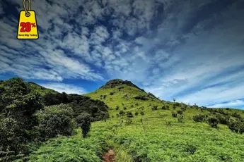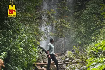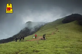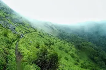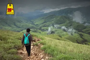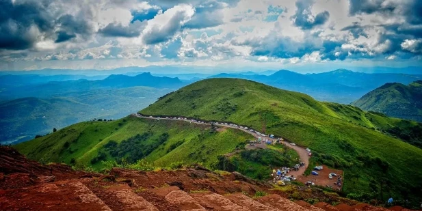
1. KudremukhKudremukh, which translates in Kannada as "horse-face," is a beautiful peak in Karnataka's Chikmagalur district. At 1,894 meters (6,214 feet), one of the third-highest Karnataka peaks forms a Western Ghats feature. Abundant greenery, soft rolling meadows, foggy valleys, and wide views distinguish the route. It is found in the Kudremukh National Park, a protected area famous for its variety of plants. The journey is ideal for those who love adventure and nature since it has a modest degree of difficulty at around 20 kilometres (to and from).History of KudremukhOriginally managed by Kudremukh Iron Ore Company Ltd (KIOCL), Kudremukh was an important supplier of iron ore mining. Included now in the Kudremukh National Park, a UNESCO World Heritage Site, the mining operations have been halted to protect the area's surroundings. Named for the unusual shape of the mountain seen from a certain vantage point that somewhat looks like a horse's head, the park and the walk are preferred by wildlife enthusiasts and academics alike. Kudremukh is also a focal point of biodiversity, including many native species.Nearby Places of KudremukhKudremukh National Park: Guests can tour the national park, which houses leopards, wild dogs, Malabar civets, and hornbills, and investigate its environs apart from trekking.Hanuman Gundi's cascades of waves: This magnificent cascade, located some 20 kilometres from Kudremukh in lush forests, offers a tranquil recreational pastime.Kalasa: Kalasa, a little village near Kudremukh, is well-known for its lovely scenery and its Kalaseshwara Temple honouring Lord Shiva.Best Time to Visit Kudremukh TrekJune to September monsoon: During the monsoons, the area changes into a brilliant paradise with thick flora, fast rivers, and misty valleys. Heavy rain makes the trails dangerous and slippery, so it is only advised for seasoned hikers equipped with adequate rain gear. Hot and not quite attractive from March to May.Monsoon Magic between June and September: With lush vegetation, rushing rivers, and misty-covered valleys, the area becomes a vivid paradise during the monsoons. But it is advisable only for seasoned trekkers with adequate rain gear, as severe rain makes the paths slick and difficult.March to May: Warm and Less Pictorial, Kudremukh's climate turns drier and warmer with summer. Although the trip is still doable, the vegetation vanishes, and the path gets increasingly tiring under the sun. Less well-known this season is less well-known because of the lower temperatures and decreased visual beauty.How to Reach KudremukhBy Airport: Around 100 km away is Mangalore International Airport, the closest one. From the airport, you can take a bus or hire a cab to go to Kudremukh or the base village of Mullodi.By Train: Mangalore Junction is the nearest railway station and links major cities like Chennai, Mumbai, and Bangalore. From the station, go by road to Kudremukh.By Road: Kudremukh is easily reachable by road. From Bangalore (about 330 kilometres), Mangalore, or Chikmagalur, you can take a KSRTC bus or drive to Kalasa. Local jeeps departing Kalasa get to Mullodi, the starting village for the trip.2. Chembra PeakThe highest point in Wayanad, Kerala, is Chembra Peak, 2,100 metres (6,890 feet). It is situated in the Western Ghats and offers scenic views of rolling hills, tea estates, flora and fauna.... The scenic beauty and moderate difficulty of the trek make it a popular choice among nature enthusiasts and casual hikers. The hike is famous for its heart-shaped lake (Hridaya Saras), and the fact that it has remained waterless is one of its most iconic features. Prior authorisation from the forest department is required for the trek..History of Chembra PeakFor many years, Chembra Peak has been held in high esteem by its inhabitants and visitors. Despite not being closely linked to mythological narratives, the Wayanad area holds historical importance due to its ecological and cultural significance. Now the heart-shaped lake near the summit has become a symbol of romance and natural beauty, drawing couples as well as photographers from around the country. Moreover, the highest point is situated within the Wayanad Wildlife Sanctuary to safeguard the diversity of species.Nearby Places to Explore: Chembra PeakHeart-Shaped Lake (Hridaya Saras): Wayanad's trekkers can easily find a picturesque heart-shaped lake that'll be one of their most photographed attractions.Soochipara Falls: After your trek, take a dip at this three-tiered waterfall located just 12 km from Meppadi.Pookode Lake: It is a beautiful, forest-covered freshwater lake perfect for relaxing on the boat.Edakkal Caves: These ancient caves, which contain prehistoric petroglyphics and are situated approximately 40 km away, are a must-see for any history enthusiast.Best Time to Visit Chembra PeakOctober to February: The best times for trekking are during winter and after the monsoon. The weather is typically clear and sunny, with good visibility and lush greenery. Make the most of this time to enjoy breathtaking views of the apple orchard-shaped lake.June to September: A thrilling expedition through misty midst, lush foliage and rapids downriver?. Trekking is generally banned by forest officials during heavy rains due to safety concerns.March to May – Summer: In the summer, what are the typical dry weather conditions in Wayanad? Trekking is still possible, but the scenery becomes less lush, and hiking trails can become too challenging to walk on in the sun.How to Reach Chembra Peak.By Airport: Located approximately 92 km from Chembra Peak, Calicut International Airport (Kozhikode) is the closest airport. You will be taken to the base village of Meppadi by taxi or local transportation..By Train: The railway station close to Kozhikode provides easy access by road to major cities. Taxis and buses: Access to Meppadi station.By Road: The 15 km distance from Kalpetta and Sultan Bathery makes it easy to reach Chembra Peak by road. Starting from Meppadi town, the trek can only begin after receiving approval from the forest department at the Chembra Peak Trek Office.3. Rajmachi Fort TrekTens of kilometres away from Lonavala, in the Sahyadri mountains of Maharashtra, lies the hill fort of Rajmachi. This fortress is quite impressive. At the fort are located the two twin citadels, Shrivardhan and Manaranjan. Both of the Western Ghats can be seen from these panoramic views. The 2,710 feet (826 meters) above sea level is where Rajmachi, a popular trek for both beginners and experienced hikers, descends. That’s not the hardest trip yet. This place is rich in history, with its verdant forests and centuries-old pathways providing a scenic backdrop.History of Rajmachi FortA major Marathasian fort is the Rajmachi Fort. Shivaji Maharaj took control of it in the 17th century and established a strategic foundation for the fort. It was then conquered by the Mughals and later by both India and the British. The location's proximity to the Bhor Ghat, a significant trade route connecting Mumbai and Pune, made it an ideal military installation. The remains of a crucial, architecturally significant fortification consist of its ruins, temples, and water reservoirs.Nearby Places of Rajmachi FortShrivardhan and Manaranjan Forts: Rajmachi Fort is home to two main fortresses that boast impressive monuments and cultural heritage.Kondhane Caves: The Karjat trail commences at ancient Buddhist caves, which can be a convenient stopover.Lonavala & Khandala: Visiting the Bhushi Dam, Tiger's Leap, and Duke’s Noses is recommended before or after a hike. These areas are situated close to several waterfall destinations..Visapur and Lohagad Forts: These forts, located close to Lonavala, are ideal for trekking.Best Time to Visit Rajmachi FortJune to October: The most stunning time to go is this one. It becomes verdant with waterfalls cascading down and hills enveloping the meadows.' To avoid the slippery terrain, it is advisable to wear trekking shoes.November to February: The weather is expected to be ideal. Winter is a time of peace as the weather is pleasant, making trekking more comfortable. The. The mountains and forts around can be seen with clear skies.March and May: Although the trek can be done in summer, it can become too hot and dry. To prevent high temperatures, start your day early and bring enough water.How to Reach Rajmachi Fort.By Airport: The airport that is closest to Pune is the International Airport, which is located at a distance of roughly 95 km. The options for transportation to Lonavala include taking cabs or taking the train.By Train: The closest train station to Mumbai and Pune is Lonavala Railway Station. To get to the base village of Lonavala, either walk or take a vehicle.By Road: Two primary routes lead to Rajmachi: Starting from Lonavala, the route is less complicated and requires a longer journey of 15 km on foot or taking a 4x4 ride to Udhewadi. The journey from Karjat involves a steep and challenging descent through Kondhane Caves.4. Tadiandamol TrekThe tallest peak in Karnataka, Tadiandamol, is the third highest. Tadiandamol, situated in the Western Ghats, is a journey that offers breathtaking views, rolling hills, misty terrain, and clear forests, just beyond Kakkabe. This is a popular trek for both beginners and experienced hikers because of its moderate difficulty. The route passes through Shola woodlands, coffee grounds and panoramic views, especially spectacular from the top.History of TadiandamolTadiandamol is renowned for its stunning natural features and its historical significance. It was ruled by the Kodava monarchs, and the Nalknad Palace nearby, built in the 18th century, is a testament to the region's royal history. The palace still stands today. The trek route runs alongside this ancient royal residence, adding a cultural twist to the experience.Nearby Places of TadiandamolNalknad Palace: A site with a rich history at the foot of the trek. It is an excellent example of architecture and history that can be enjoyed at this 18th-century palace....Chelavara Falls: Located approximately 15 km from Tadiandamol, this stunning waterfall is perfect for unwinding and taking photos of the natural surroundings.Madikeri: Coorg's district headquarters, which includes the coffee estates, Abbey Falls, and Raja’s Seat. Ideal for exploring post-trek.Igguthappa Temple: Near Kakkabe, a significant religious destination for Kodavas. The environment is both calming and culturally significant.Best Time to Visit Tadiandamol Trekpost-monsoon: The post-monsoon and winter months offer clear skies, cool temperatures, a lush greenery. The most recommended time for the trek is during this season, as it offers a pleasant and scenic experience.June to September: The monsoon season runs from June to September. A lush green haven with flowing rivers and thick fog fills the area. However, during heavy rains, the trail becomes muddy, and leeches are present. Only individuals with the appropriate gear and experience are recommended to embark on trekking..March to May: Summer runs from the months of March to May until May. While it's warm in the summer, trekking is still a good option. Despite the greenery diminishing in late spring, early morning hikes are within reach. This time is less crowded.How to Reach TadiandamolBy Airport: It is the nearest airport, which is Kannur International Airport (approx.). 90. The airports in Mangalore and Bangalore are also available as alternatives.By Train: Mysore (125 km) and Kannur (110 km) are the nearest railway stations. You can either take a cab or a ferry to Kakkabe or Napoklu from there.By Road: Road access is a convenient feature for Tadiandamol. Madikeri or Virajpet can be reached by driving or taking a bus to Kakkabe, the closest village to the trek's starting point. About 1-3 km away from Kakkabe is the base point can be found.5. Lohagad Fort Trek, MaharashtraThe Lohagad Fort, also known as "Iron Fort," is a well-known hill fort in Maharashtra, particularly near Pune and Lonavala. It is famous for its impressive fortifications, extensive walls, and sweeping views of the Sahyadri range, situated at an elevation of around 1,033 meters (3,389 feet). Those who are new to hiking and those interested in history will find Lohagad to be a relatively easy route. The fort's distinctive Vinchu Kata (Scorpion’s Gracia) is well-known as a natural, rugged spur of rock that serves as an anchor.History of Lohagad FortLohagad Fort was built during the 1st century AD and later became significant during Chhatrapati Shivaji Maharaj's rule, under the Maratha Empire. Its use of it was strategic to control trade routes and protect the region from potential invasions. The Marathas and Mughals exchanged ownership of the fort on several occasions. Lohagad, a site of Maratha architecture and military innovation, boasts grand gates, fortified walls, water reservoirs, and caves. This is the epitome of their craft.Nearby Places to ExploreLonavala and Khandala: Lohagad-specific hill stations, famous for their scenic views, cascading waterfalls, and local delicacies such as chikki.Bhaja and Karla Caves: The ancient caves cut from Buddhist rock near Lonavala are a must for those interested in history and archaeology.Tiger's Leap and Duke's Nose: The Western Ghats and the valley below are a sight to behold, with many scenic viewpoints set aside near Lonavala.Visapur Fort: A trekker’s destination with a rich history and breathtaking views is also present near Lohagad, known as Visapur Fort.Best Time to Visit Lohagad FortJune to September: From June to September, the Monsoon Season is in full swing. This is the most popular time to visit Lohagad Fort as the area becomes green with waterfalls and hills covered in mist. Caution should be used as the trail can be slippery.'October to February: The Winter months extend from October to February. Trekking and sightseeing are well-suited to the pleasant and cool climate.. The fort is characterised by its clear skies, which provide excellent views.March to May: From March to May, the summer season takes place. Even though the trek is still possible, it can get very hot in a day. Early morning treks are suggested to avoid the sun at midday.How to Reach Lohagad Fort.By Airport: The nearest airport to Lohagad is Pune, which has a distance of around 65 km from Pune International Airport. Both Lonavala and the nearby town of Lohagad can be reached by taxi or bus from the airport.By Train: Mumbai and Pune are connected by the Lonavala railway station. Local transport or a short taxi ride from Lonavala station, about 8 km away from the footbridges.By Road: It takes around 30 minutes to reach Lohagad Fort from Pune by road. 60. 120. Bus, cab and private vehicle to the base camp near Lonavala or a village in Malavali.6. Mullayanagiri Trek, Karnataka.The highest mountain in Karnataka is Mullayanagiri, which is located in the Baba Budangiri range of India and situated in Karnataka, with a summit elevation of 1,930 meters (6,330 feet). The Chikmagalur trek is renowned for its stunning mountainous landscapes, refreshing temperatures and abundant greenery. Click to learn more about the trek. This relatively short but steep trail attracts both novices and experienced hikers. The peak is home to a small temple dedicated to Lord Shiva, which boasts an adventurous and spiritual vibe.History of MullayanagiriAt its highest point, the Mullaya Lingeshwari Temple is a landmark in Mullawayanagiris.com. The name originates from the Kuruba tribe's deity, which is referred to as "Mullayanagiri," and it signifies the "Peak of Mullaya.". The local church has a rich and long-standing history of faithfulness. Mullayanagiri is considered one of the most spiritually rich places in the Western Ghats, owing to its abundance of plant and animal life. Other areas are also located there.Nearby Places of MullayanagiriBaba Budangiri Hills: A second mountain range is renowned for its caves, coffee-drinking regions, and religious sites that are also accessible for trekking.Kudremukh National Park: The local biodiversity centre, which features trails and diverse wildlife.Chikmagalur Town: Known for its tea culture, Chikmagalur is the hub of Karnataka's tea and coffee regions with numerous coffee estates, scenic spots, and waterfalls.Hirekolale Lake: The lake near Mullayanagiri is a serene spot for picnics and enjoying the evening sun.Best Time to Visit MullayanagiriOctober and February: The best time to go is between October and February. Trekking is most successful after the monsoon, especially in winter, when it's cool, pleasant to be around and with spectacular views..June to September: Despite being lush, the trail can be treacherous and slippery even in heavy rain. The hike is truly paradise. Only experienced hikers should take advantage of this opportunity.'March to May: The temperature rises, and the air's permeability diminishes. Early morning treks can be done to avoid the afternoon heat.How to Reach Mullayanagiri.By Airport: The nearest airport to this place is around 150 km and that's Mangalore International Airport.? From the airport, Chikmagalur can be reached with the help of public transport or cab services.By Train: The most convenient and accessible railway station to major cities is the Chikmagalur Railway Station. You can travel to Mullayanagiri using taxis or buses starting from this point.By Road: The roads in Mullayanagiri are well-kept. Around 15 km from Chikmagalur town, you can easily reach the footpaths by taking a taxi or a local bus that stops near Sunkeri village.7. Agasthyarkoodam Trek, KeralaAgasthyarkoodam, which is 1,868 metres (6,129 feet) high, is one of the tallest mountains in the Western Ghats. Take a look at the diverse fauna, unique medicinal plants, and spiritual significance of Neyar Wildlife Sanctuary in Thiruvananthapuram district.com/home. It's a moderately difficult trip through dense woodland and to diverse wildlife. Those who enjoy the outdoors, such as adventurers and vacationers, make an appearance.History of AgasthyarkoodamDedicated to the memory of Agastya, who is revered in Hindu mythology for his contribution to spreading Vedic knowledge throughout South India. The mountain is considered sacred, and many people come to pay homage to the god at the shrine located near the top. Among the local tribes, the medicinal plants and traditional herbal knowledge are still in the hands of those who reside there.Nearby Places of AgasthyarkoodamNeyyar Wildlife Sanctuary: A sanctuary for elephants, deer and birds.Neyyar Dam: The popular picnic spot near the sanctuary is well-used and has boating facilities.Bonacaud: A tranquil village with tea estates and waterfalls, perfect for a morning or afternoon run. All the trimmings here. Enjoy the charm.Kallar Waterfalls: A quaint waterfall is close to the hike. Perfect for a refreshing break.'Best Time to Visit AgasthyarkoodamJanuary to March: The best time of year is from January to March. This is the time. With clear skies, moderate temperatures, and less rainfall, these months are ideal for trekking.Monsoon Season (June to September): In order to safeguard the delicate ecosystem from ice, trekking is typically only permitted during the monsoon.April to June: In comparison to the ideal months, trekking becomes less comfortable due to increased temperatures and rainfall.How to Reach AgasthyarkoodamBy Airport: About 50 km (100 mi) is the closest airport, which is also known as Trivandrum International Airport. Both the Taxi and bus services can transport you to either Bonacaud or Neyyar Dam from the airport.By Train: Major cities are easily accessible from the closest railway station to Thiruvananthapuram Central. You can reach the trek base by taking a local bus.'By Road: It is possible to travel from Thiruvananthapuram and reach Agasthyarkoodam via road at Bonacaud or Neyyar Dam. The trek can be done from both locations.Why Book with escape2exploreWhen exploring Treks in Karnataka and beyond, escape2explore stands out as a trusted name in adventure and experiential travel. Here’s why hundreds of travellers choose us for their getaways:Trusted, Well-Reviewed Local Operator: escape2explore has gained the trust of thousands of content tourists all over India. With persistent positive feedback and an unblemished reputation for delivering quality experiences, we assure you that your experience will be hassle-free, memorable, and value-packed. Our insider local knowledge guarantees that you will always be in safe hands.Seasoned Guides: Our trips are led by friendly, trained, and professional guides who are passionate about the outdoors and your safety. Whether it's a beach trek, a cultural tour, or a spiritual walk through temples, our team knows the terrain, the stories, and how to make each moment count.Safe & Curated Itineraries: Your safety is our number one priority. Our tour packages are thoughtfully crafted with safety measures, researched accommodations, and easy travel arrangements. We take care of the details so you can have the experience hassle-free and worry-free.Unique Experience That You Won't Find Anywhere Else: With escape2explore, you discover more than the tourist attractions. We go off the beaten track with hidden beaches, unusual treks, offbeat cultural destinations, and true interactions.Read: Foods to Pack for Treks|Highest Peak Kalsubai|Wonders of Kerala|Prepare for Your First Trek|Trek Fit India


