dayshrsminsec
Login

Summer Treks in Uttarakhand

One Day Trips Near Bangalore

One Day Trips Near Bangalore

Two Day Trip From Bangalore

Two Day Trip From Bangalore

Best Summer Treks in Uttarakhand for Beginners and Experienced Trekkers

Known as “The Land of Gods”, the “Heaven of India”, Uttarakhand, is a place of unparalleled beauty to the trekkers. The destination hosts some of the finest views of Himalayas right from its vast undulating verdant valleys to its vast alpine meadows as well as its soaring icy summits, frozen rivers or glares, age-old edifices to its most holy expedition paths. High-alt-mountain treks remain inaccessibility till its snow caps melt and so with advent of summer season. High high Himalayan trails of Uttarakhand open up to make a traveller enjoy splendid excursions. For trekking enthusiasts, summer season is an inviting period for Valley of Flowers, Roopkund, Pindari Glacier, Har Ki Dun, Pangarchulla, Kuari Pass, Dayara Bugyal, Kedartal, Ali Bedni Bugyal among many others. Similarly the spiritual trails like Adi Kailash, Panch Kedar, Rudranath and of course Do Dham Yatra allow you mix religious devotion, rugged adventure with serene Himalayan scenery. No matter whether you have an inexperienced soul trying out for a green field or an adept mountaineer in search for tricky expeditions high atop, Uttarakhand has every alternative for you personally!

Table of Contents

  • Overview

  • Summer Treks in Uttarakhand

  • Tips for Summer Treks in Uttarakhand

  • Conclusion

Summer trekking to Himalayas Uttarakhand, Uttarakhand the summer edition; trekking to the Himalayas in summers have a distinct aura, quite unlike the winter, which allows a spectacular opening up of mountain routes as the lower and middle level passes melt away. A wide variety of mountain ranges are a destination for trekkers in Uttarakhand during summers-the dense woods offer verdant treks to valleys, alpine meadows bloom into carpets of wild flowers, and various high altitude passes open up allowing one to walk on glacial routes or cross high mountain passes. The Valley of Flowers trekking, Har Ki Dun trek, Pindari Glacier trek, Dayara Bugyal trek, Ali Bedni Bugyal trekking, Roopkund trekking, Pangarchulla peak trek, Kuari Pass trekking- are popular choice among trekkers for their amazing mountainous vistas, in summers. Adventure as well as religious trekking to Uttarakhand mountains goes beyond these- you can also get to go on spiritual journeys to Adi Kailash Yatra, Panch Kedar Yatra, Rudranath Trek or the extremely sought-after Do Dham Yatra. Keep in mind that not all the mentioned treks to Uttarakhand mountain trails might be available for trekking during the summer, depending on high altitude passes’ duration or accessibility. Always be aware of route accessibility and current local conditions for any trek to mountains of Uttarakhand prior planning of.

Summer Treks in Uttarakhand

1. Roopkund Trek

  • STARTING POINT: Lohajung

  • ENDING POINT: Roopkund Lake

  • DIFFICULTY LEVEL: Moderate to Difficult

  • TREK DISTANCE: Approximately 50–55 KM

  • BEST TIME: May to June and September to October
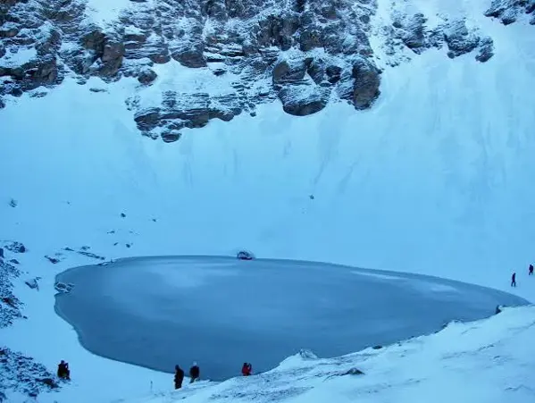
 Roopkund Trek

The Roopkund Trek: Highlights 0f The 'Skeleton Lake' High at altitudes in Uttarakhand, the Roopkund trek holds fame not only for its picturesque valleys, meadows and forested paths, but most so for its famous skeletal lake, Roopkund Lake. Lying nestled in the Chamoli district of Uttarakhand, the trek offers an unforgettable trekking in mountains experience, taking you through dense forests, open fields, rocky stretches and views of the Himalayan peaks. One must plan out their itinerary based on seasons as pass is often closed due to harsh climate. The trekking trails will include some of the best trekking experiences; trekkers usually start from the Lohajung region into forests leading to idyllic villages of Garhwal and traverse through the best of alpine meadows such as Ali and Bedni Bugyal that offer immense views of Himalayas. Beyond the meadows the terrain would gradually transform into rocky landscape eventually leading the way to Roopkund. Trekkers will gain higher altitudes by conquering some severe ups and downs on rugged and challenging terrain on most paths of the Roopkund trek and it often has varying weather patterns, due to this the Roopkund trek is ideal for those who love trekking extensively and carry prior experience in mountains. The trek demands high level of physical fitness and prior trekking expertise due to its steep ascents, challenging weather and primarily the rocky trails. The Roopkund trek is not only known for its natural beauty but is a medley of cultural variety as well with villages on the trek and scattered along the paths, natural abundance through oak forests and beautiful natural vistas comprising lush green areas. During pleasant season few patches of snow can be seen as well near the peak. Roopkund trek only starts when the pass is clear from snow.Looking for a challenging Himalayan adventure? Explore the Roopkund Trek for a memorable high-altitude trekking experience.

2. Valley of Flowers Trek

  • STARTING POINT: Govindghat

  • ENDING POINT: Valley of Flowers

  • DIFFICULTY LEVEL: Easy to Moderate

  • TREK DISTANCE: Approximately 38–40 KM round trip

  • BEST TIME: July to September

Valley of Flowers Trek

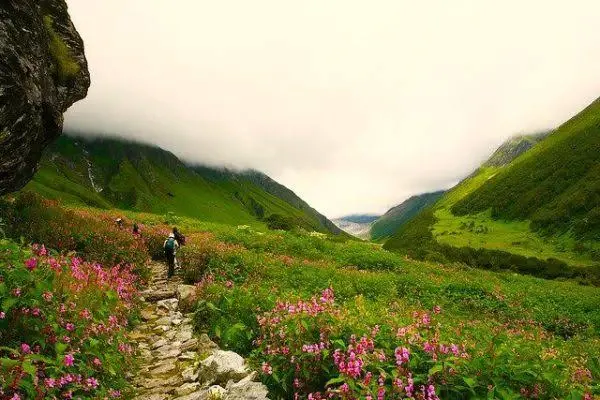
The Valley of Flowers trek is one of the best treks which is most visited and demanded among Uttarakhand treks in the Himalayas. Chamoli district in Uttarakhand, this spell binding valley lies in the Nanda Devi Biosphere Reserve which is well known among floral experts and nature enthusiasts due to a multitude of wild alpine flowers, flowing streams, high mountain range, tranquil aura. Normally trek would begin from Govindghat from here we would reach Ghangaria and our base camp for the Valley of Flowers. From Ghangaria we would trek inside to enthrall ourselves with blooming colorful flowers of this mystical valley during blooming season. The valley in the season blooms into its full glory when hundreds of thousands of species of alpine flowers, like painted gems on nature's carpet of green are spread all over the valley displaying their brilliance of red, blue, pink and yellow. The flowers like primulas, anemones, potentilla, Himalayan blue poppies are some of the prominent varieties that are found depending on the season. Not just this the entire trail showers us with fabulous views of the mountains nearby along with the chirping music of streams running along with us. Moreover, one can even add Hemkund Sahib the holy Sikh Shrine for added spiritual dimension to the trek and that to a higher altitude from The Valley of Flowers trek. It is a moderate to tough trek as due to trekking the entire day and we need to be fit enough, the views would definitely pay off our hardships. Proper trekking equipment like comfortable trekking shoes,rain wear, plenty of water to drink, sufficient layers of warm clothing as per seasons, and constant consumption of food is essential. A Nature Lover, Photographer, young family members with children and trekking debutants interested to delve into Himalayas would find this trek an ideal vacation for themselves. Amongst the list of nature tours globally, this trek is quite an enjoyable easy hike and you wouldn't need to consider it being a tough challenge to trek.Love scenic mountain landscapes and vibrant alpine flowers? Discover the Valley of Flowers Trek in Uttarakhand.

3. Pindari Glacier Trek

  • STARTING POINT: Khati Village / Dhakuri route

  • ENDING POINT: Pindari Glacier Zero Point

  • DIFFICULTY LEVEL: Moderate

  • TREK DISTANCE: Approximately 50–60 KM round trip

  • BEST TIME: April to June and September to October
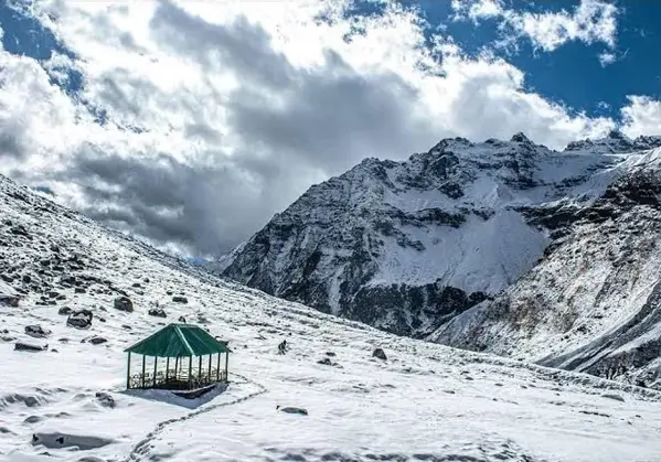
Pindari Glacier Trek

Pindari Glacier Trek is one of the many classic Himalayan trek trails in Uttarakhand which you find in Kumaon region . The route delves into the mighty Himalayas and winds past scenic forested regions , remote villages, high alpine meadows and the rock-strewn terrain of the Himalayas until it culminates at the imposing Pindari Glacier (Kumaon Himalayas). The journey is dotted along villages and camps that includes the likes of Dhakuri, Kahrkia, Khati, Dwali, Phurkia and zero point in the end. Each bit of terrain you will traverse has its very own vista- dense forests, alpine meadows, alpine rocky patches, streams and valleys. The main allure of this route for trekking purposes is an insight into relatively isolated stretches of Himalayas and views of ranges peaks, streams, waterfalls, walls and cliffs as one proceeds. ThisPindari Glacier Trek gets the “medium” category due to its altitude range, length, and long walking hours. There are no highly technical climbs required but trekkers should have good leg stamina and endurance. However, good fitness levels are important as one should be able to comfortably trek and ascend for about 5-8 hours a day. The summers are favourable around and in the initial portions of the trekking route; while snow often lingers about upper reaches during different times depending on snow. Other best times include Septembers and October, when there’s immense clarity in the Himalayan vistas. This is a suitable choice for anyone looking to traverse the awe-inspiring glacial vistas of the Kumaon region, while exploring the less-travelled valleys and pristine Himalayan terrains.Want to explore breathtaking Himalayan glaciers? Check out the Pindari Glacier Trek for an unforgettable mountain adventure.

4. Bali Pass Trek

  • STARTING POINT: Sankri

  • ENDING POINT: Janki Chatti

  • DIFFICULTY LEVEL: Difficult

  • TREK DISTANCE: Approximately 60–70 KM

  • BEST TIME: May to June and September to October
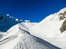
 Bali Pass Trek

The Bali Pass Trek is a demanding trek in the Himalayas, joining Tons Valley and Yamuna Valley. The high-altitude trek of the Garhwal Himalayas covers steep ascents, narrow trails, alpine meadows, forests and breath-taking views of Himalayan peaks. The Bali Pass trek typically starts from Sankri, which is a popular launching point for many Himalayan treks. Trekkers are taken across some remote villages, various forests, rivers, and high mountain camps before finally traversing the Bali Pass. The high mountain trek to the Pass with rugged trails and wide mountain views in your eyesight becomes extremely pleasurable while approaching Bali Pass. The trek can offer fabulous and breathtaking views of peaks like Swargarohini and Bandarpoonch, as per weather and visibility. The Bali Pass Trek is absolutely not an option for novice trekkers. It requires a fairly high degree of levelness, as well as prior understanding of undertaking Himalayan treks and sufficient mental toughness. Along the trek, you can observe various unique remote hill villages and experience old mountain cultures, which you won't even find while trekking on the commonly chosen paths. The summer is the main time to walk for Bali Pass (before the monsoons kick off). However, be prepared for snow depending on the actual trail to cross-whether there is snow or not. You're urged to gain proper trail report of recent pass conditions before starting this expedition.Experienced trekkers seeking a challenging route can explore the Bali Pass Trek through the stunning Himalayan wilderness

5. Gaumukh Tapovan Trek

  • STARTING POINT: Gangotri

  • ENDING POINT: Tapovan

  • DIFFICULTY LEVEL: Moderate to Difficult

  • TREK DISTANCE: Approximately 40–46 KM round trip

  • BEST TIME: May to June and September to October
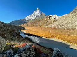
Gaumukh Tapovan Trek

Among all the beautiful high altitude treks in Uttarakhand Gaumukh Tapovan Trek would stand out. The trek begins at the holy town of Gangotri and subsequently climbs down to the well-known snout of the river Bhagirathi-Gaumukh, and from there to the serene meadows of Tapovan. This trek is a wonderful mixture of divinity, adventure, glacier and enchanting Himalayan beauty. Gangotri which is one of the most important pilgrimage sites in Uttarakhand adds to the divinity of the trek for devotees and at the same time refreshes nature lover. The slopes on the route are quite steep with river valleys, rocky terrain and high altitude regions. The trek down to Gaumukh allows the trekkers to experience the wonderful Gangotri glacier and surrounding Himalayan gigantic peaks. Tapovan is a mesmerizing sight with meadows full of colorful flowers and amazing Himalayan views especially the imposing Shivling peaks make the backdrop seem more imposing. It is one of the best possible campsites that could be found, and the panoramic Himalayan views from this site are mind blowing. Physical fitness and endurance are essential for this trek since it falls under extreme altitude regions with strenuous terrain. One would also need to be completely well acclimatized while traveling up to high altitudes. Climate in the glacier and high altitude terrain can change without any notice and one needs to be extra careful. It would be advisable for trekkers to possess prior high altitude trekking experience before undertaking this Gaumukh Tapovan trek. Summer and early fall are the best seasons for the trek, but all dependent upon weather conditions and permission from the local authorities. The divine settings of the place along with the presence of glaciers, meadows and imposing snow-capped Himalayan mountains make the Gaumukh Tapovan trek an unforgettable expedition.Experience dramatic Himalayan peaks and glacier landscapes on the spectacular Gaumukh Tapovan Trek.

6. Har Ki Dun Trek

  • STARTING POINT: Sankri

  • ENDING POINT: Har Ki Dun Valley

  • DIFFICULTY LEVEL: Easy to Moderate

  • TREK DISTANCE: Approximately 45–50 KM round trip

  • BEST TIME: April to June and September to November
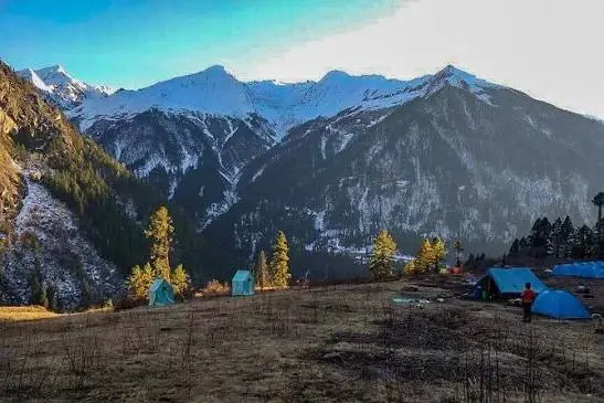
Har Ki Dun Trek

Har Ki Dun trek is one of the most beautiful and culturally significant treks in Uttarakhand. It is called the “Valley of Gods” for a good reason, given it rests within the folds of lush greenery within the Govind Pashu Vihar National Park. It is a saucer-shaped valley and presents breath-taking views of forest, villages, rivers, meadows and the towering Himalayas. The trek starts from Sankri and progresses through tiny mountain hamlets to finally reach the Har Ki Duncot-shaped valley. You can easily observe the picturesque life of the inhabitants as you pass through quaint villages like Taluka and Osla. From Sankri to Taluka, the trail follows the River Supina and then ascends into the valley to the National Park where a series of ancient temples dots the green landscape. One of the biggest draw of the valley are the splendid views of the mountain ranges surrounding the valley in the horizon with the sky and landscape in the foreground. The valley is popular among novice trekkers due to the relatively easy ascent (as compared to other treks in Uttarakhand). The landscape unfolds from green to snow-capped to dotted with alpine flowers in different seasons of the year. Birdwatching, flora and fauna and serene vistas contribute in making this trek an unparalleled experience. The trail is a fantastic mix of dense pine forests, meadows, and streams while the imposing massifs of Garhwal Himalayas serve as a panoramic backdrop.Looking for a scenic valley trek? Explore the Har Ki Dun Trek through beautiful mountain villages and lush landscapes.

7. Pangarchulla Trek

  • STARTING POINT: Dhak / Auli region

  • ENDING POINT: Pangarchulla Summit

  • DIFFICULTY LEVEL: Moderate to Difficult

  • TREK DISTANCE: Approximately 35–40 KM round trip

  • BEST TIME: April to May and November to December
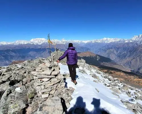
Pangarchulla Trek

Pangarchulla trek is a grand high altitude adventure in Garhwal Himalayas and one of the most famous trek among the others in the region, mostly for its summit push and mesmerizing view of some great himalayan peaks. The trek is a passage through forests, meadows, snow-covered patches and rocky terrain to the summit. Depending on the season, parts of the upper section of the trek might be under the blanket of snow and turn the whole trek into a white himalayan wonderland. What stands out most among others is the summit climb of pangarchulla. The trek towards the top of pangarchulla may seem arduous due to it’s steep ascent, needs presence of mind and a fit body at times especially if the path leading to the summit is snow laden. The view of the peaks and ridges surrounding from the summit is amazing and the visual appeal is simply breath-taking. The path to pangarchulla is also through some beautiful forests of oak and rhododendrons and in the month of spring when rhododendrons bloom, lower section of the trek adorns some lovely colors. This trek is more of a trek for experienced trekkers. It does not involves technical mountaineering but, the high altitude, tough climbs and snow and tricky weather conditions can be really tough for someone, who has done some low altitude trek before. This is a more suitable trek for those who are a little familiar with mountain trekking. Ideal season to trek Pangarchulla largely depends on the conditions of snow. Spring is one of the widely accepted seasons for experiencing snow in the high altitudes of Pangarchulla.Take your Himalayan adventure to the next level with the challenging Pangarchulla Trek and its incredible mountain views.

8. Kuari Pass Trek

  • STARTING POINT: Dhak / Auli region

  • ENDING POINT: Kuari Pass

  • DIFFICULTY LEVEL: Moderate

  • TREK DISTANCE: Approximately 30–40 KM

  • BEST TIME: April to June and September to November
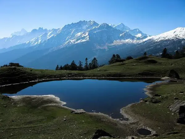
Kuari Pass Trek

A Brief Introduction to Kuari Pass Trek One of the popular passes treks of Uttarakhand is the trek to the Kuari Pass which means gateway to the mountains. During Kuari Pass trekking you have remarkable views of a range of famous peaks of the Himalayas. Your trek goes through charming forests, alpine meadows, remote mountain villages and some high ridgelines, with options that bring you close to areas such as Auli, Gorson Bugyal and the regions close to the Pass. One of the highlight of the trek is the vistas of the Himalayas, from where, if you get fortunate with a good weather day you would have views of peaks after peaks standing over the ridge as far as eyes could see. However, spring time brings in Rhododendron flowers that make the trek very special, while autumn has the best chance of clear skies and views. This trek is graded as moderate, meant for those who can spend considerable amount of walking time and are at least moderately fit, and it generally requires spending at least some time walking uphill as well as steeper sections, but not as harsh as those done at the higher passes and technical trekking destinations. The trek passes through dense forests and also opens to some open and undulating terrain. Camping in alpine regions adds more beauty for a truly different experience of traveling away from typical places of interest for visitors. Though summer and the weeks after monsoons make most of the passes in the Himalayas trek friendly, weather may vary. Kuari Pass trekking route also experiences similar weather patterns, so one should ensure conditions are feasible to trek prior starting the trek. The trek is an apt alternative to various tough treks but offers a glimpse into a real Himalayan pass-crossing, without being overly intense in difficulty for average trekking enthusiast. Enjoy panoramic views of Himalayan peaks and beautiful mountain trails with the Kuari Pass Trek.

9. Ranthan Kharak Trek

  • STARTING POINT: Munsiyari

  • ENDING POINT: Ranthan Kharak

  • DIFFICULTY LEVEL: Moderate to Difficult

  • TREK DISTANCE: Approximately 40–50 KM

  • BEST TIME: May to June and September to October
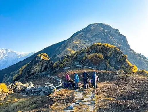
Ranthan Kharak Trek

Ranthan Kharak Trek is a trek of less commercialized fame among the many Kumaon's famous trails in Uttarakhand that cater to wanderers seeking a less crowded yet enthralling sojourn amidst the Himalayas. The trek begins in the tranquil mountain village of Munsiyari and treks its way through alpine forests, lush meadows, panoramic ridge-walks and high altitude regions. Beginning from the mesmerising town of Munsiyari, flanked by views of high altitude peaks of the Himalayas, the trekkers have plentiful amount of sights and wonders to witness along as they traverse higher terrains. As we progress up the trail, dense vegetation slowly morphs into expansive alpine terrain, affording breathtaking, panoramic views of the Himalayan ranges. It has the rare merit of being a relatively unexplored terrain, and therefore provides better chances for trekkers to spend solitude in the Himalayas. Moderate Fitness Level Since the hike requires traveling to higher elevations for a couple of days and involves long stretches of walking and elevation gain, participants will be require some trekking experience on similar trails. Higher regions in the mountains often witness radical weather shifts, hence participants should pack clothes that can accommodate extreme changes in climate. Best Season Early to Mid Summer. This time of the year offers optimal access to the higher terrains in the region with respect to snow; however, the exact route may be conditioned by ground-level circumstances.Discover a quieter Himalayan adventure surrounded by beautiful mountain scenery on the Ranthan Kharak Trek.

10. Adi Kailash Yatra

  • STARTING POINT: Dharchula / Gunji region

  • ENDING POINT: Adi Kailash region

  • DIFFICULTY LEVEL: Moderate to Difficult

  • TREK/TRAVEL DISTANCE: Varies by itinerary

  • BEST TIME: May to October, subject to permits and weather
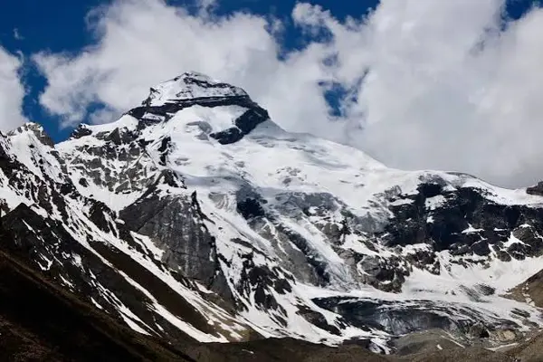
Adi Kailash Yatra

Adi Kailash Yatra: A Sacred Himalayan Odyssey One of the most rewarding spiritual expeditions to the Himalayas in Uttarakhand is the Adi Kailash Yatra, a journey to the sacred mountain of Adi Kailash, situated near the Sino-Indian border in the Kumaon Himalayas. It is one of the preferred destinations in the Himalayas for those seeking a meaningful spiritual expedition. The Adi Kailash Yatra The trip is generally started from Dharchula; you travel to the higher remote villages like Gunji, Nabhi and Kuti before moving on to the rest of the region. Other valleys form an indispensable section of most of the iternary itineraries. Unlike traditional trek destinations in the Himalayas, the Adi Kailash Yatra integrates the ride on vehicular options, few patches of walks, spiritual and mythological sites along with the high altitude terrain explorer expedition in a way that will offer a divine glimpse. In a nutshell it is a fusion of rough terrains, rivers, valleys and religious destinations. The route incorporates several stops which have ties in the local tradition and Hindu myths and legends making the journey one-of-a-kind to experience the serenity of remote region and spirituality from closer aspect of life. The destination's closeness to a sensitive border zone & its height means that the procedures to obtain permits, restrictions and road-related regulations can often vary. Thus prior to embarking on the expedition it would be always pertinent to inquire about the authentic requirement of visit; especially on ground, beforehand. It is best considered for people looking for more than the usual. Those physically adept and comfortable with journey into the extremely isolated parts of Himalayas. If spirituality combined with heavenly Himalayan landscape, adventure, culture, history etc. Is your idea of adventure holiday and you are considering a pilgrimage holiday in Indian Himalaya, do not miss the sacred Adi Kailash Yatra.Planning a spiritual Himalayan journey? Learn more about the Adi Kailash Yatra through the sacred landscapes of Uttarakhand.

11. Panch Kedar Yatra

  • STARTING POINT: Gaurikund / different route-specific bases

  • ENDING POINT: Panch Kedar Temples

  • DIFFICULTY LEVEL: Moderate to Difficult

  • TREK DISTANCE: Varies significantly by itinerary

  • BEST TIME: May to October, subject to temple openings and weather
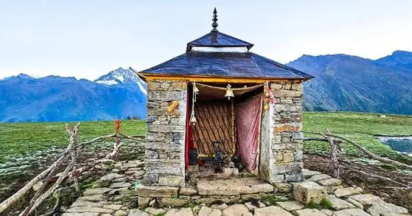
Panch Kedar Yatra

The Panch Kedar Yatra is a spiritual sojourn of utmost significance in the Garhwal Himalayan region of Uttarakhand, a significant pilgrimage undertaken to seek blessings from the Lord Shiva at his abode across five unique and revered shrines located at various altitudes across this region. It consists of the following five holy sites:

  • Kedarnath

  • Tungnath

  • Rudranath

  • Madhyamaheshwar

  • Kalpeshwar

This pilgrimage is a unique odyssey in the form of several diverging trekking routes in place of a single trail, making this overall travel into a challenging physical ordeal as much as a spiritually elevated one. While trekking through verdant valleys, traditional villagers and dense forests to these pristine spots on the laps of higher Himalayas. Trekking to such unique locations gives the trekkers the essence of the Garhwal Himalayas’ immense diversity in term of flora, fauna and beauty coupled with the spiritual heritage that still resides in such remoteness within Uttarakhand. Out of these five temples, Tungnath is one of the highest Shiva temples of the world, whereas Rudranath is known for its remote mountain habitat surrounded by thick Himalayan forests.mSimilarly, Madhyamaheshwar and Kalpeshwar have their distinct features with varying Himalayas' landscapes to experience. Depending on how many of the five temples to travel, difficulty level varies, but an ideal yatra of these five shrines can last from several days to about 1-2 weeks depending on their accessibility. The yatra season can be planned once all these temples open for trekking, which typically occurs in the summer post a difficult winter. Panch Kedar Trek/Yatra is especially suitable for the trekkers who look forward to experiencing a healthy blend of pilgrimage and the challenging trekking adventures in the pristine environs of Uttarakhand.Explore Uttarakhand's sacred Himalayan temples and spiritual trails with the Panch Kedar Yatra.

12. Rudranath Trek

  • STARTING POINT: Gopeshwar / Sagar Village route

  • ENDING POINT: Rudranath Temple

  • DIFFICULTY LEVEL: Moderate to Difficult

  • TREK DISTANCE: Approximately 20–24 KM one way depending on route

  • BEST TIME: May to October, subject to temple opening and weather
Rudranath Trek

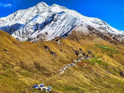
Rudranath Trek is amongst the five sacred Panch Kedar routes for devotees of Lord Shiva. In Uttarakhand, the remote Rudranath Temple, set at the foothills of high Himalayan peaks, offers alpine meadows, lush greenery and awe-inspiring mountain views. The trek offers spiritualism combined with wild landscapes. Different from many other pilgrimage routes where the destination might be easily accessible by roads for a part of the journey, the route to Rudranath demands considerable walking through rather remote areas for several kilometers. The journey unfolds through dense forests, high mountain ridges, sweeping grasslands and rural Himalayan settlements. The view keeps becoming wider and grander as one ascends through the terrain showcasing high-altitude Himalayan peaks. The natural beauty around Rudranath Temple in a peaceful setting attracts travellers seeking some time away from the bustling tourist spots for rejuvenation. Due to the long walking distances involved in the trek and the considerable altitude climb, it may become a tough journey and one needs a good stamina for the trek. Generally the trek is carried out during summers and early autumnal season. However, the travel options depend upon when the temple opens to the general public and the prevailing climatic condition in the regions.Combine spirituality and mountain adventure by exploring the scenic Rudranath Trek in Uttarakhand.

13. Do Dham Yatra

  • STARTING POINT: Haridwar / Rishikesh

  • ENDING POINT: Badrinath and Kedarnath

  • DIFFICULTY LEVEL: Moderate

  • TRAVEL DISTANCE: Varies by itinerary

  • BEST TIME: May to October, subject to temple opening and weather
Do Dham Yatra

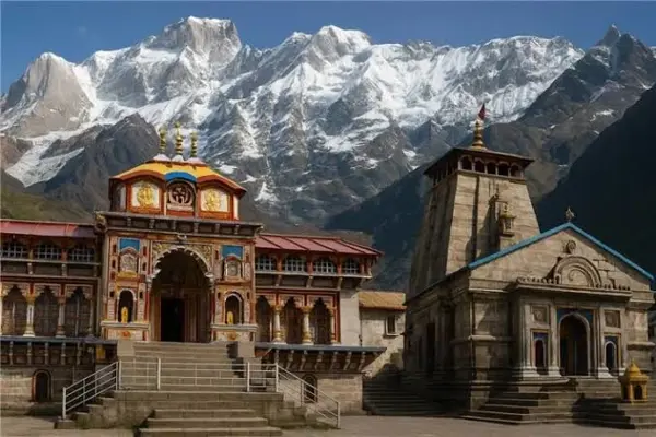
Do Dham Yatra Is Best Pilgrimage circuit Of uttarakhand Which covers both The Himalayan Abodes-Kedarnath & Badrinath. The journey of Do DhamYatra covers the most iconic places for pilgrim sites, mountain vistas, old traditional Pilgrimage routes and cultural immersion. Kedarnath is a renowned shrine for Lord Shiva which lies amidst the awesome Himalayan valley. It requires hiking at length and hence Fitness will remain paramount. It is built on the riverside of Alaknanda River, with lofty Himalayan peaks in back. Depending on Package & route you chose for travel to reach those shrines can be by trekking, road and other authorized vehicle modes to reach sacred spots. Summer is a busy time to travel for pilgrims due to their reopening post their annual break. Climate is generally pleasant during summer. However, landslides and rains are frequent which can alter or put hindrances in trip itinerary/plan. Booking of accommodation and transportation is very essential from the onset, especially in summer. It is advisable for the visitors to keep themselves informed about policies related to the latest update about temples’ reopening/ closures and latest travel advisory, local weather etc. Anyone who wish to embark on such a sublime, awe-inspiring spiritual trip this year can undoubtedly opt for it.Planning a pilgrimage in the Himalayas? Discover the Do Dham Yatra for a spiritual journey through Uttarakhand.

14. Dayara Bugyal Trek

  • STARTING POINT: Barsu Village

  • ENDING POINT: Dayara Bugyal

  • DIFFICULTY LEVEL: Easy to Moderate

  • TREK DISTANCE: Approximately 20–25 KM round trip

  • BEST TIME: April to June and September to November
Dayara Bugyal Trek

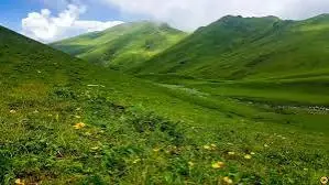
Dayara Bugyal Trek is amongst the finest meadow treks in the region of Uttarakhand. Bugyal, which means an alpine meadow at high altitude, this meadow stretches as far as your eyes can see, offering majestic views of the Himalayan panorama. The trek to Dayara Bugyal can begin from a base such as Barnsu village and progresses through dense beautiful woods, leading eventually to these spectacular meadows. It’s for a simple reason that the trek to Dayara Bugyal is also amongst the ideal beginner treks, especially for families who are willing to tread their way to a relaxed Himalayan escapade. During summer, the grasslands take on a vibrant green hue and in close vicinity, one can also witness stunning vista of the nearby high mountains. The woods along the way comprising mainly of oak and rhododendron species provide shelter as you move through a rather pleasant stretch. Amongst the many aspects of Dayara Bugyal, an open space comes at a foremost spot rather than meandering between trees, here the landscape is much larger; these vistas offer the joy of freedom and widen scope for picture clicking, camp, and of course the serene silence of the Himalayas. Due to its moderate altitude and manageable trekking trail, Dayara Bugyal has the distinction of becoming ideal for someone considering trekking in the Himalayas for the first time. However, as much it's of great choice for beginners, be mentally prepared for long hours of walk along with rapidly fluctuating mountain weather conditions. In addition, depending on the program chosen, the trip can also be extended to visiting nearby attractions. Therefore, for travelers keen to savor alpine meadows along with beautiful forests, great Himalayan views, and tranquil camping spots, Dayara Bugyal has to be the best option during the summer months in Uttarakhand. Looking for expansive alpine meadows and beautiful Himalayan views? Explore the Dayara Bugyal Trek.

15. Hemkund Sahib Trek

  • STARTING POINT: Govindghat

  • ENDING POINT: Hemkund Sahib

  • DIFFICULTY LEVEL: Moderate to Difficult

  • TREK DISTANCE: Approximately 38–40 KM round trip

  • BEST TIME: July to September, subject to opening dates and weather
Hemkund Sahib Trek

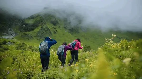
The Hemkunt Sahib trek is a divine pilgrim trek in Himalayas leading to one of the most sacred Sikh pilgrim destinations in India called Gurudwara Sri Hemkunt Sahib. The site is based in Chamoli district of the Indian Himalayas and is widely popular among tourists and pilgrims who are on search of spirituality and nature's wonder. Starting from Govindghat the trek first proceeds towards Ghangaria. As one reaches the destination from where the trek proceeds to Hemkunt Sahib then the path to the holy shrine is a sharp rise. The path to Hemkunt Sahib passes through forests, waterfalls, streams, rugged and rocky paths and the surrounding varies with the altitude gaining high. The final stretch leading to Hemkunt Sahib is quite tough as it has a very fast rate of gaining altitude. It is essential that the pilgrim is medically fit. Maintain the pace according to comfort. Take adequate rest while climbing to the holy shrine. At Hemkunt Sahib sits next to a beautiful high altitude lake surrounded by the mighty Himalayan peaks. During pilgrim season people gather from India and abroad to offer prayers and take blessings of the almighty and deities. Along with Valley of Flowers Hemkunt Sahib & valley of flowers trek offers you a spell bounding journey in the Himalayas. Valley of flowers is known for its wild and alpine flowers, whereas Hemkunt Sahib is known for its divine beauty. The pilgrim season in Hemkunt Sahib is very brief due to heavy snow fall during winters and due to the very high altitude. Summer booking can only depend on the official statement and the condition of the trek path at that time. Pilgrims seeking spiritually; a panorama and religious trek should not miss paying a visit to Hemkunt Sahib.Plan a meaningful mountain pilgrimage with the Hemkund Sahib Trek, known for its sacred high-altitude destination.

16. Dodital Trek

  • STARTING POINT: Sangam Chatti

  • ENDING POINT: Dodital Lake

  • DIFFICULTY LEVEL: Easy to Moderate

  • TREK DISTANCE: Approximately 20–25 KM round trip

  • BEST TIME: April to June and September to November
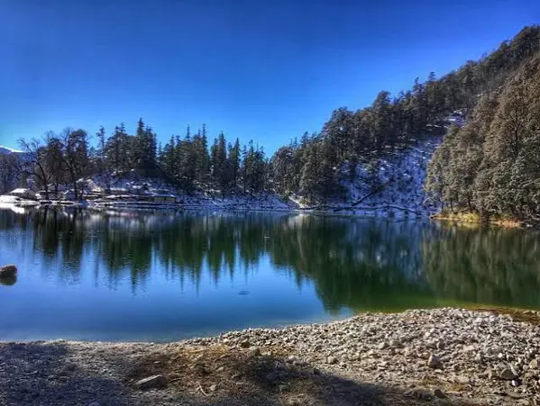
Dodital Trek

Dodital Trek is the amazing and captivating forest and lake trekking destination which is located in Uttarakhand. This is the path which goes on the Dodital, the calm fresh water lake where on all sides are very thick forests and mountains. Generally, trekking can start from Sangam Chatti. The trekking route of the Dodital passes through various forest trails, streams, and natural landscapes. Since it is less tiring compared to another peak trekking, it can also be called as trek for amateur trekking expedition. In ancient time, in the area around the lake there was Lord Ganesha. That is why people also call it as sacred place and trekking to this lake provides immense joy due to its unique natural beauty as well. The calm and beautiful lake that is surrounded by forest provides a perfect spot for camping. During the months of summer, the Doditaltrek gets covered with lush green trees all over. Throughout the trek, the weather remains pleasant and nice. As the Dodital trek routes and surrounds areas are surrounded by many of the Himalayan ranges and thick forest. The birdswatchers and nature lover would definitely feel it like a haven. Dodital trek can be extended to Darwa Pass, for those who love difficult trek with a complete Himalayan view. The Dodital trek is suitable for the trekkers that do have fitness or say beginner level, if you are planning for trek with family which do have past trekking experience, and for nature lovers. Keep yourself well with trekking shoes and rain gear due to fast changing weather in mountain. If you are seeking for an ideal blend of forest trekking, lakeside camping, mythology and scenic Himalayas than, Dodital trekking must be on your list.Escape into peaceful forests and mountain landscapes with the scenic Dodital Trek in Uttarakhand.

17. Tungnath Chopta Trek

  • STARTING POINT: Chopta

  • ENDING POINT: Tungnath Temple

  • DIFFICULTY LEVEL: Easy to Moderate

  • TREK DISTANCE: Approximately 4 KM one way

  • BEST TIME: April to June and September to November
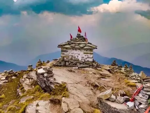
Tungnath Chopta Trek

Tungnath Chopta Trek falls under the category of 'easier Himalayan trek' in Uttarakhand state. Chopta is known as the \"Mini Switzerland of Uttarakhand\" due to its thick alpine forests, lush green meadows and scenic outlook. Chopta to Tungnath trek is relatively short, though it consists of a climb throughout the route until the Tungnath temple. One of the five sacred temples of the Panch Kedar, Tungnath is known to be one of the highest Shiva temples of the world. The track from Tungnath has magnificent views of the Himalayas surrounding the region. The trail goes through the meadow to the beautiful divine Tungnath temple through a verdant alpine trail covered with rhododendron in spring and summers. There is a further ascend possible to Chandrashila Summit from Tungnath, an added experience for the travelers, which offer spectacular panoramas of the entire Himalayas. This short ascent from Tungnath Temple provides some of the most amazing views of the surrounding Himalayas. A shorter altitude as compared to other trekking destinations in Himalayas makes the Tungnath expedition favorable for the novice trekking beginners as well as travelers wanting to have a shorter rendezvous with the majestic Himalayas. Though moderate fitness is advisable due to the higher altitude and upward gradient on the trail. Summer can be ideal time to undertake this trek, but the weather at Tungnath can change unexpectedly and it can become worst at any time. It is also packed during any religious festivals along with duringall pilgrim season. This destination is for a short, visually stimulating, peaceful and divine experience with the Himalayas while trekking, which novice trekkers love in the form of Chopta Tungnath Trek.Explore beautiful Himalayan scenery and a sacred mountain temple with the Tungnath Chopta Trek.

18. Kedartal Trek

  • STARTING POINT: Gangotri

  • ENDING POINT: Kedartal Lake

  • DIFFICULTY LEVEL: Difficult

  • TREK DISTANCE: Approximately 35–40 KM round trip

  • BEST TIME: May to June and September to October
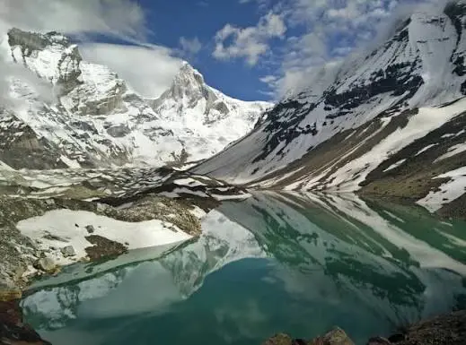
Kedartal Trek

Kedartal Trek A tour among the finest trekking tours in the Garhwal Himalayas, the Kedartal trek takes off from the starting point Gangotri, and concludes at Kedartal the sacred lake of Lord Shiva in the lap of the giant Himalayas. Once you start from Gangotri, the first station of your voyage, it’s a steep hike up to the Kedartal Lake. It is among the hardest treks of Garhwal Himalayan ranges. You cross through divers landscapes - rocky barrenlandscapes; lush greenery; glaciers as your journey is moving to KedarTal; rugged terrain. The Kedartal trek The high altitudes and steep ascents require adequate fitness levels and some experience with high-altitude trekking, for it will be an up and down journey for you to manage through Kedartal Trek. The Kedartalan glacial lake which is perched at high altitudes, below the mountain peaks like the Thalay Sagar(6904m), Bhrigupanth (6772m), Manda (6510m), will serve as a valuable treasure that marks Kedartal trek. The mountains can be viewed as a replica of the whole range reflecting on Kedartal. Kedartal trek is one trip to consider if you have trekking in your veins.Experienced trekkers can discover dramatic mountain scenery and a high-altitude glacial lake on the Kedartal Trek.

19. Phulara Ridge Trek

  • STARTING POINT: Sankri

  • ENDING POINT: Suriya Top / route-dependent

  • DIFFICULTY LEVEL: Moderate

  • TREK DISTANCE: Approximately 25–30 KM

  • BEST TIME: May to June and September to November
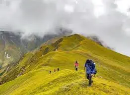
Phulara Ridge Trek

Phulara Ridge Trek is a unique Himalayan trail famous for its extended ridge-walking experience. Unlike many treks where the trail remains inside valleys or forests, Phulara provides long stretches of open ridgeline with panoramic mountain views. The trek generally begins from Sankri and passes through forests and alpine landscapes before reaching the ridge sections. Walking along the ridge provides a feeling of being surrounded by mountains on both sides. During summer, the forests become lush green and the higher meadows offer beautiful views. Depending on weather conditions, trekkers can enjoy clear views of Himalayan peaks throughout the route. The moderate difficulty makes Phulara Ridge suitable for trekkers who have some basic trekking experience. The trail still requires good stamina because of multiple climbs and long walking days. One of the biggest attractions is the sense of openness. The ridge allows trekkers to enjoy expansive landscapes rather than following a narrow valley route. Phulara Ridge is an excellent option for travellers looking for something different from conventional Himalayan treks. It combines forests, meadows, ridges, mountain views, and peaceful campsites. For photographers and adventure lovers, the ridge sections offer excellent opportunities to capture panoramic Himalayan landscapes.Enjoy distinctive ridge-walking trails and sweeping mountain views on the beautiful Phulara Ridge Trek.

20. Chandrashila Trek

  • STARTING POINT: Chopta

  • ENDING POINT: Chandrashila Summit

  • DIFFICULTY LEVEL: Easy to Moderate

  • TREK DISTANCE: Approximately 8–10 KM round trip
  • BEST TIME: April to June and September to November

 Chandrashila Trek

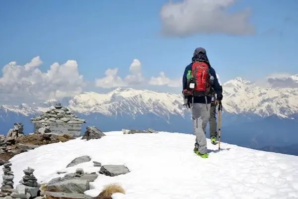
Chandrashila Trek is one of the most popular short Himalayan treks in Uttarakhand. Starting from Chopta, the route passes through Tungnath before continuing toward the Chandrashila summit. The trek is famous for its spectacular panoramic views of the Himalayan range. From the summit, trekkers can enjoy views of several prominent peaks, making the final climb particularly rewarding. The trail from Chopta to Tungnath is well-known and relatively manageable, while the final section toward Chandrashila is steeper. The combination of altitude and gradient means trekkers should have basic physical fitness. During summer, the landscape around Chopta becomes lush green, and rhododendron flowers can be seen along the trail. Clear weather can provide excellent mountain visibility. The trek also has strong spiritual significance because Tungnath Temple lies along the route. This makes Chandrashila attractive to both adventure seekers and spiritual travellers. Because the trek can be completed in a short duration, it is suitable for travellers with limited time who still want to experience a Himalayan summit. For beginners looking for a rewarding mountain climb, Chandrashila is one of the most accessible summit experiences in Uttarakhand.Want breathtaking Himalayan summit views? Explore the Chandrashila Trek via the scenic Chopta region

21. Gulabi Kantha Trek

  • STARTING POINT: Dayara / route-dependent

  • ENDING POINT: Gulabi Kantha

  • DIFFICULTY LEVEL: Moderate

  • TREK DISTANCE: Approximately 25–35 KM

  • BEST TIME: May to June and September to November
Gulabi Kantha Trek

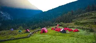
Gulabi Kantha Trek A secluded HImalyan Escape Gulabi Kantha trek is an alternate stunning yet less popular trekking routes in the Himalayas of Uttarakhand. This trek involves forest regions, meadows of Himalayas, mountains view and a beautiful and serene atmosphere during trek. Trekkers get a glimpse of the typical Himalayan vista where the woods eventually give way to grassy pastures.depending upon the season, the path gets a variety of colourful flowers such as rhododendrons along meadows, when a trekker reaches up. Another redeeming part of Gulabi Kantha trek is its solitude. Trekkers who prefer a bit of isolation from bustling trekking spots in the Himalayas are likely to have a wonderfully isolated and relaxing trek in this terrain. Treks to Gulabi Kantha can be of moderate grade, containing ascent and descent portions, so this may be best suited for trekkers in moderate health. Camping in the meadows has a heaven on earth feel under the stars of the sky and in the heart of mountains. The best time to opt this trek for trekking is in summers as the weather conditions would be favourable, the landscape of this region becomes entirely Green. However it's always good to check and be cautious about weather and path before you commence for trekking. Gulabi Kantha is an excellent choice fornature lovers,nature photographs and a trekker who wishes to experience an altogether different Himalayan vista. Discover peaceful Himalayan trails and panoramic mountain scenery with the Gulabi Kantha Trek.

22. Satopanth Trek

  • STARTING POINT: Mana Village

  • ENDING POINT: Satopanth Tal

  • DIFFICULTY LEVEL: Difficult

  • TREK DISTANCE: Approximately 35–40 KM round trip

  • BEST TIME: May to June and September to October
Satopanth Trek

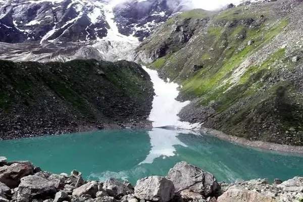
Tough Himalayan journey through varied landscapes to magical Satopanth Tal high up in Garhwal Himalayas near Badrinath. Satopanth Tal is not just about beautiful Himalayan panorama with its unique geological features but is enriched by the presence ofmythological elements, especially Hindu mythology. The trekking trail passes through the remote area of Garhwal Himalayas that includes the starting journey from near Mana Village, one of the most remote inhabited villages just before you have reached tointernational border line. The trek leads you across many types of terrains from valley floor to the steep and rocky sections at much high altitude. The Satopanth Tal or the lake ofTruthis located just below Chaukhamba peak. The beautifully shaped, triangular-sized lake reflects the surrounding sky and huge, snow covered Himalayan peaks perfectly, creating the serene, stunning landscape for those adventurous souls. The arduousness of the trek comes due to the altitude, high steps & rocky sections and volatile mountain weather conditions. It requires better physical conditioning and a bit of prior knowledge regarding high-altitude trekking. Moreover, you can soak up with mythological tales spread all over region during this trek and make this adventure spiritually uplifting. Due to higher altitudes, acclimitization at each camp site is quite indispensable. Generally summer and autumn present suitable weather but local guidance and information on current scenario is must to make the plan effective and sure to go. This trekking experience is definitely recommended for serious and experienced treks having done some high altitude trek before.For a demanding high-altitude adventure, explore the Satopanth Trek through the spectacular Garhwal Himalayas.

23. Kalindi Khal Trek

  • STARTING POINT: Gangotri

  • ENDING POINT: Badrinath / Mana region

  • DIFFICULTY LEVEL: Extremely Difficult

  • TREK DISTANCE: Approximately 90–100 KM

  • BEST TIME: June to September, subject to conditions and permissions
Kalindi Khal Trek

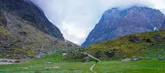
Kalindi Khal Trek, a true high-altitude mountain expedition, offers some of the most challenging trekking trails of Uttarakhand. Trek route from Gangotri (Uttarakhand) cuts across the Kalindi Khal, one of the high Himalayan Pass linking Gangotri and Badrinath regions. Kalindi Khal is a true high altitude mountain trek for experienced trekkers and mountaineers, with steep rock slopes, snow fields and glaciers making it demanding and technically challenging at points. This high mountain adventure trek also takes us to extremely high altitudes where weather is highly capricious and prone to sudden change. We will be rewarded by breathtaking view of the Himalayas. This entire trek route is a trek into the untouched interiors of Himalayas along the side of glaciers. Highlights : crossing over high Kalindi Pass The trek requires to cross a challenging snow and ice pass that remains snow-covered round the year and thus a true trek for a prepared trekker/mountaineer. The route involves considerable amounts of trekking over glacial terrains, snowfields, steep slopes and also the most amazing passes. Be prepared for some serious leg workout. Not advisable for the beginners not for intermediates. Experienced Himalayan trekker and an outdoor enthusiast can dare taking this on with experienced team. Limited days in the season due to snow cover and other logistic requirements. If you are a hardcore mountain lover and an outdoor enthusiast and looking for the real challenge from Himalayas, then look no further from the above Kalindi Khal trek itinerary.Experienced mountaineering enthusiasts can learn about the challenging Kalindi Khal Trek across the high Himalayan terrain.

24. Ali Bedni Bugyal Trek

  • STARTING POINT: Lohajung / Wan route

  • ENDING POINT: Ali Bedni Bugyal

  • DIFFICULTY LEVEL: Moderate

  • TREK DISTANCE: Approximately 25–30 KM

  • BEST TIME: May to June and September to November
Ali Bedni Bugyal Trek

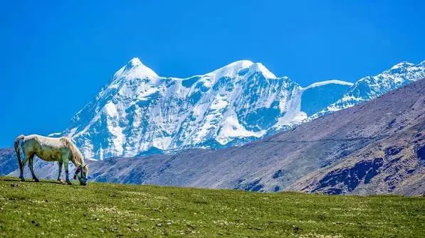
One of the most classic alpine meadow treks in Uttarakhand, Ali Bedni Bugyal Trek takes you to the striking high-altitude meadows of Ali Bugyal and Bedni Bugyal, situated amid dramatic Himalayan vistas. The trek typically starts at/near Lohajung and, after trekking through woods, the scenery explodes into immense stretches of alpine meadows, a transition that is as awe-inspiring as the meadows themselves. Ali and Bedni are most recognized for their vast panoramic views of the Himalayan range across. On a clear day, the trekkers get a spectacular view of these lofty giants across the horizon. While in the summer the meadows explode in vibrant shades of green, ideal for setting up campsites and exploring the floral riches, the autumn views in golden hues against the crisper autumn sky offers a contrasting yet equally memorable view. It’s a moderate trek and can be a good introductory trek for people with a certain level of trekking fitness, since the altitude can be a concern. The trek can be combined with some other interesting itineraries in the area depending on your itinerary. This is the perfect option for travellers wishing to experience the traditional Himalayas in their glorious high altitude meadows without embarking on overly challenging climbs.Explore vast alpine meadows and beautiful mountain views on the scenic Ali Bedni Bugyal Trek.

Tips for Summer Treks in Uttarakhand

  • Not every Uttarakhand trek is suitable throughout summer.

  • Himalayan weather can change quickly.

  • Prepare with walking, cardio, and stair-climbing exercises.

  • Temperatures can vary significantly between day and night.

  • Pre-monsoon and monsoon weather can bring sudden rainfall.

  • Choose footwear with good grip and ankle support.

  • Carry sufficient water and use reliable purification methods when needed.

  • Give your body enough time to adjust to high altitude.

  • Sunglasses, sunscreen, and a hat are useful at higher elevations.

  • Avoid littering and follow Leave No Trace principles.

Conclusion

From blooming floral wonders and lush alpine meadows like Valley of Flowers, Aali Bedni Bugyal to gruelling high altitude passes like Kedartal, Satopanth and Kalindi Khal, Uttarakhand has one of the highest diversities for Himalayan trekking. Open up some of the most beautiful and enthralling treks of Uttarakhand starting in Summer or let your spiritual side wander off to these pilgrimage trails like Adi Kailash Yatra, Panch Kedar Yatra, Rudranath trek and Do Dham Yatra. There’s a trek for one and all in Uttarkhand this Summer, be it beginners as there is Dayara Bugyal,Dodital, Tungnath-Chandrashila and The Valley of Flowers in this itinerary or trekking gurus who would rather choose the Bali Pass trek, Gaumukh Tapovan trek and Kalindi Khal trek and Satopanth and Kedartal with all due precautions. Always confirm the current season update on weather forecasts, permits, local guidelines, route availability and exact opening dates of these treks beforehand.

...

One Day Trips Near Bangalore

Explore All

Two Day Trip From Bangalore

Explore All
01

Bali Pass Trek from Sankri: 8 Days over a 16,207 ft Pass

4.8
(40 Ratings)
Bali Pass Trek from Sankri: 8 Days over a 16,207 ft Pass

8D/7N

Starts On

₹21849/- ₹31212/-
Book Now
4.8
(40 Ratings)

Activity location: Uttarkashi (Sankri Base Camp), Uttarakhand

Trip Duration: 8 Days | 7 Nights

Max. Altitude: 16,207 Ft.

Bali Pass Trek Distance: 56 Km round trip.

Best Time to Visit: April mid, May, June and September-October

Bali Pass Trek Difficulty: Easy to Moderate

Accommodation: Stay at a guest house/ homestay/Swiss tents/ dome tents during the trek as per the sharing pattern/occupancy opted.

Meals: Vegetarian meals served from Khati Village, rotational menu day-wise

About Bali Pass Trek, Uttarakhand

The Bali Pass Trek is an 8-day crossover trek in the Uttarkashi district of Uttarakhand that links the Har Ki Dun valley with the Yamuna valley by way of a high pass at 16,207 feet. It begins at Sankri and ends at Yamunotri, covers about 56 km and is one of the more demanding routes in the Garhwal Himalaya, since it combines steep climbs, snow and long days. Despite the rating on this page (easy to moderate), plan for a hard trek and train for it. The route starts with arrival at Sankri on day 1. Day 2 is the walk from Sankri to Seema, and day 3 continues from Seema to Rainbasera. On day 4 you reach Ruinsara Tal, a glacial lake in a bowl of peaks. Day 5 climbs to Odari, and day 6 goes on to base camp below the pass. Day 7 is the crossing itself, from base camp over Bali Pass and down to Lower Dhamni. On day 8 you walk from Lower Dhamni to Yamunotri. On clear days you see Swargarohini, Bandarpoonch and Kala Nag. The best windows are mid-April to June and September to October, when the pass is open and the trail is most stable. Weather can change quickly near the pass, so the trek leader may adjust the timing of the crossing. Stays are in guest houses or homestays where available and in tents higher up, depending on sharing. Meals are vegetarian, with a rotating menu from Khati village onwards. The trek suits people who have completed an earlier high-altitude Himalayan trek and walk regularly. Check dates on this page, and ask us about permits, fitness and gear before you book. We can also share a training plan for the weeks before departure. Many of our guests begin trekking in the Himalayas after a few weekend treks near Bangalore.

...
02

Ali Bedni Bugyal Trek from Rishikesh: 6 Days of Alpine Meadows

4.7
(49 Ratings)
Ali Bedni Bugyal Trek from Rishikesh: 6 Days of Alpine Meadows

6D/5N

Starts On

₹10999/- ₹15712/-
Book Now
4.7
(49 Ratings)

Activity location: Chamoli, Uttarakhand

Trip Duration: 6 Days | 5 Nights

Altitude: 12,100 Ft.

Ali Bedni Bugyal Trek Distance: 24 Km.

Best Time to Visit: March-June & September-November

Ali Bedni Bugyal Trek Difficulty: Moderate

Accommodation: Stay at a guest house/homestay/Camping During the Trek.

Meals: All meals from your arrival to departure from the base camp are included (Morning Tea, Breakfast, Lunch, Hi-Tea with Snacks, and Dinner). We provide simple, nutritious yet tasty vegetarian meals & eggs on all days of the trek.

About Ali Bedni Bugyal Trek, Uttarakhand:

The Ali Bedni Bugyal Trek is a 6-day meadow trek in the Chamoli district of Uttarakhand, starting from Lohajung and climbing to Ali Bugyal and Bedni Bugyal, two of the largest high-altitude grasslands in the Garhwal Himalaya. The meadows sit above 11,000 feet, the whole route is about 24 km, and the grade is moderate. Mount Trishul and Nanda Ghunti stand across the valley for much of the walk. It is also the first half of the Roopkund route, so it works well for people who want the same scenery without the final summit. The plan begins with the drive from Rishikesh to Lohajung on day 1. Day 2 starts the trail towards Roopkund, with a steady climb through forest and the village of Didna. On day 3 you reach the meadows above the cloud line. Day 4 explores the meadows, Bedni Kund and the temple area, a trail tied to local legends of the goddess Nanda Devi. Day 5 comes down through forest to a mountain hamlet, and day 6 follows valleys and river confluences back to Rishikesh. The best time is March to June and September to November. Spring brings rhododendron blooms and some snow, while autumn gives clear air and cold nights. In July and August the meadows are in full bloom but the rain is heavy. Wildlife includes the Himalayan monal, the state bird of Uttarakhand, which you may see on the high slopes. The trek suits people who want a high-altitude meadow walk without technical sections. Stays are in guest houses, homestays or camping, and meals are vegetarian with eggs on trek days. Check dates on this page and tell us your Rishikesh arrival time. Ask us for a packing list before you book.Looking for a bigger challenge? Browse our Himalayan trek packages.

...
03

Kalindi Khal Trek from Gangotri: 14 Days Across a 5,947 m Pass

Kalindi Khal Trek from Gangotri: 14 Days Across a 5,947 m Pass

14D/13N

Starts On

₹101999/- ₹145712/-
Book Now

Activity Location: Uttarkashi, Uttarakhand

Trip Duration: 14 Days | 13 Nights

Best Time to Visit: May, June, September, October

Trekking Distance: 65-70 KM

Max. Altitude: 6,000 Meter(19,685 feet)

Shivling Kalindi Pass Trek: Difficult

Meals: Vegetarian meals

Accommodation: Camping Tent (Triple/Quad Sharing)

About Kalindi Pass Trek, Uttarakhand:

The Kalindi Khal Trek is a 14-day high-altitude crossing in Uttarakhand from Gangotri to Mana, by way of Kalindi Khal, a glacier pass at about 5,947 metres. The route covers around 65 to 70 km, goes over the Gangotri and Chaturangi glaciers and ends in the Badrinath valley. It is among the most demanding treks in the Indian Himalaya, with exposed glacier travel, steep ice and snow, boulder fields and several very cold camps. The grade is hard, and it is meant for trekkers with high-altitude experience and good fitness. adventure. The plan starts with a drive from Dehradun to Gangotri and a trek to Bhojbasa. The route continues through Nandanvan and Vasuki Tal, with rest days for acclimatisation along the way. The team then crosses the Shweta glacier to Kalindi Base Camp. The pass day is long and starts early, from base camp over Kalindi Khal to the camp on the far side, with roped sections and technical terrain. After the pass, the route descends to Ghastoli and finishes at Mana, near Badrinath, where a vehicle takes the group onward. The best windows are late May to June and September to early October. Fresh snow can hide crevasses, and bad weather can delay the crossing, so spare days are built into the plan. Permits for the Gangotri National Park are needed and the paperwork takes time. Stays are in tents with vegetarian meals, and guides and porters travel with the team. The trek suits experienced trekkers who are comfortable with ropes, ice and long days at altitude. A first-timer should start with a lower pass, such as a trek that crosses 4,500 to 5,000 metres, before attempting this crossing. Ask us about the skills needed, the permit timeline and the dates before you book. Trekkers often describe the journey as transformative, a rare blend of inner peace and outer adventure. Himalayan trekking needs more preparation than a day hike, so start training early.

...
04

Satopanth Expedition from Gangotri: 21 Days to a 7,075 m Peak

Satopanth Expedition from Gangotri: 21 Days to a 7,075 m Peak

21D/20N

Starts On

₹349999/- ₹499998/-
Book Now

Activity Location: Chamoli, Uttarakhand

Trip Duration: 21 Days | 20 Nights

Best Time to Visit: May, June, September, and October

Trekking Distance: 80-90 KM

Max. Altitude: 7,075 meters (23,212 feet)

Satopanth Trek Difficulty Level: Difficult to Challenging

Meals: Vegetarian meals

Accommodation: Camping Tent (Triple/Quad Sharing)

About Satopanth Trek, Uttarakhand.

The Satopanth Expedition is a 21-day high-altitude climb in the Gangotri region of Uttarakhand to Satopanth Peak at about 7,075 metres. It is not a regular trek but a technical mountaineering trip that follows the Gangotri glacier route through Bhojbasa, Nandanvan and Vasuki Tal, and then goes on to higher camps on glacier and snow. Along the way you see Shivling, Meru, Thalay Sagar and Bhagirathi peaks from close range. The grade is hard, and the climb is for people with prior mountaineering experience, since it involves rope work, glacier travel and several very cold nights. The plan starts with a drive from Dehradun to Gangotri, followed by the trek to Bhojbasa, the first camp on the glacier route. From there, the route continues to Nandanvan and Vasuki Tal, with time for acclimatisation and rest days along the way. After Vasuki Tal, the team moves onto high camps for the summit push, which takes advantage of a weather window. Several days are kept in reserve for bad weather. The return follows the same route back to Gangotri and Dehradun. The best windows are late May to June and September to October, when weather is more stable and crevasses are better covered. The monsoon brings heavy snowfall and risk on the glacier. Permits for the Gangotri National Park and mountaineering permissions are required, and the arrangements take time. Stays are in tents, with vegetarian meals, and the team travels with guides and porters. Basic mountaineering skills, previous high-altitude experience and a strong fitness base are required. Most climbers prepare for months, with endurance training, cold-weather practice and at least one earlier trip above 5,500 metres. Ask us about the skills needed, the permit timeline and the dates before you book. Discover serene beauty on our Kanasar Lake Trek.Our high-altitude treks need good fitness, so train for a few weeks first.

...
05

Gulabi Kantha Trek from Dehradun: 5 Days to a 3,789 m Ridge

Gulabi Kantha Trek from Dehradun: 5 Days to a 3,789 m Ridge

5D/4N

Starts On

₹7999/- ₹11427/-
Book Now

Activity location: Uttarkashi, Uttarakhand

Trip Duration: 5 Days | 4 Nights

Best Time to Visit: April to June and September to November

Trekking Distance: 28-30 KM

Max. Altitude: 3789 Meters

Gulabi Kantha Trek Difficulty Level: Moderate

Meals: Vegetarian meals

Accommodation: Camping Tent (Triple/Quad Sharing)

About Gulabi Kantha Trek, Uttarakhand.

The Gulabi Kantha Trek is a 5-day trek in the Uttarkashi district of Uttarakhand to Gulabi Kantha, a ridge at about 3,789 metres, with the route starting from Dehradun. The trek covers around 28 to 30 km through oak and rhododendron forest, meadows and old villages, and at the top you see Swargarohini, Bandarpoonch, Kalanag and other peaks, along with the Rupin and Supin valleys. It is a quieter route than the more popular treks in the area, and the grade is moderate, making it a good step up for people who have done a Himalayan trek before. The plan starts with a drive from Dehradun to the start village on day 1. Day 2 is the trek through forest to the first camp, with a steady climb and views opening up. On day 3 you walk to the high meadow camp near the ridge. Day 4 is the ridge day, with an early start to Gulabi Kantha and a return to camp or the next stop for the descent. Day 5 finishes with the descent to the road head and the drive back to Dehradun. The best windows are April to June and September to November. In spring the rhododendron is in bloom, and in autumn the air is clear and the peaks are sharp. Winter brings snow on the top sections, and the monsoon makes the route wet. The ridge is open and windy, so carry a windproof jacket and gloves. Stays are in tents on triple or quad sharing, with vegetarian meals. The trek suits people who walk regularly and want a short high ridge with fewer crowds. Check dates on this page and ask us about the Dehradun pickup before you book. Take on the Nanda Ghunti Peak Expedition and scale one of the most captivating summits in the Garhwal Himalayas.For snow and thin air, look at our high-altitude treks in the Himalayas.

...
06

Chopta Chandrashila Trek from Rishikesh: 3 Days to a 4,000 m Summit

Chopta Chandrashila Trek from Rishikesh: 3 Days to a 4,000 m Summit

3D/2N

Starts On

₹6999/- ₹9998/-
Book Now

Activity location: Rudraprayag, Uttarakhand

Trip Duration: 3 Days | 2 Nights

Best Time to Visit: May to June & September

Trekking Distance: 15 Km

Max. Altitude: 4,000 meters

Chopta Chandrashila Trek Difficulty Level: Moderate

Meals: Vegetarian meals

Accommodation: Camping Tent (Triple/Quad Sharing)

About Chopta Chandrashila Trek, Himachal Pradesh.

CThe Chopta Chandrashila Trek is a 3-day trek in the Rudraprayag district of Uttarakhand from Rishikesh to Chandrashila, a summit at about 4,000 meters, by way of Chopta and Tungnath. Chopta is a meadow and forest base often called the mini Switzerland of India. The route covers about 15 km on foot, climbs through rhododendron and oak forest to Tungnath, the highest Shiva temple in the world at about 3,680 metres, and then goes a short way further to Chandrashila, where Nanda Devi, Trishul, Kedarnath and Chaukhamba stand in view on a clear morning. The grade is easy to moderate. The plan starts with a drive from Rishikesh to Chopta on day 1, with the evening free in the meadows. Day 2 is the main day: an early walk from Chopta to Tungnath, then on to Chandrashila for the view, and a return to Chopta. Day 3 offers a short walk to Deoria Tal, a small lake that reflects the Chaukhamba peaks, before the drive back to Rishikesh. The trail is wide and well laid, and the steepest part is the last climb to the summit. The best windows are March to June and September to November. In winter, the upper trail is under snow and the summit is cold and windy, while in the monsoon the route is wet and clouds often hide the peaks. Mornings give the clearest view, so an early start matters more than anything else. Stays are in a camp or guesthouse at Chopta, with vegetarian meals. The trek suits first-time trekkers, families with older children and anyone who wants a short summit with a large view. Carry a warm jacket, a rain layer and trekking shoes with grip. Check dates on this page and ask us about the Rishikesh pickup time before you book. Embark on a trans-Himalayan trek from Rumtse to Tso Moriri, traversing vast plateaus, high passes, and surreal Ladakhi landscapes alongside nomadic camps and turquoise alpine lakes.A Himalayan trek is a very different experience from the Western Ghats, with higher altitude and colder nights.

...
07

Phulara Ridge Trek from Dehradun: 6 Days Along a High Ridge

4.8
(57 Ratings)
Phulara Ridge Trek from Dehradun: 6 Days Along a High Ridge

6D/5N

Starts On

₹10499/- ₹14998/-
Book Now
4.8
(57 Ratings)

Activity location: Uttarkashi, Uttarakhand

Trip Duration: 6 Days | 5 Nights

Best Time to Visit: May to June and Sep to Oct

Trekking Distance: 26-30 Km Trek

Max. Altitude: 3,710 Meters

Swargarohini Trek Difficulty: Moderate

Meals: Vegetarian meals

Accommodation: Camping Tent (Triple/Quad Sharing)

About Phulara Ridge Trek, Uttarakhand:

The Phulara Ridge Trek is a 6-day trek in the Uttarkashi district of Uttarakhand, starting from Sankri and climbing to a high ridge at about 3,710 Meters . The route covers around 26 to 30 km and passes through oak and rhododendron forest, alpine meadows and old villages of the Supin valley. It is one of the less crowded routes of the Govind National Park area, and from the ridge you can see Swargarohini, Bandarpoonch and other snow peaks. The grade is moderate and the trek works well as a first high-altitude route. The plan starts with a drive from Dehradun to Sankri on day 1, the gateway to Har Ki Dun, Kedarkantha and several other treks. Day 2 is the trek from Sankri to Sikolta, through forest trails and past village fields. On day 3 you climb from Sikolta to Bhoj Gadi, into the alpine meadows. Day 4 is the ridge day, going from Bhoj Gadi to Pushtara by way of Phulara Ridge, with long views in every direction. Day 5 is the trek from Pushtara to Taluka, followed by a drive to Sankri. Day 6 is the drive from Sankri to Dehradun. The best windows are May to June and September to October. Spring brings blooming rhododendron and warm days, while autumn gives the clearest skies. Winter snow closes the high sections, and the monsoon is wet. The ridge is open and exposed, so carry a windproof jacket and gloves even in clear weather. Stays are in tents on triple or quad sharing, with vegetarian meals. The trek suits people who want a route with big views and few other groups, and who walk regularly. Check dates on this page and ask us about gear and the Dehradun pickup before you book. Choosing between treks in the Himalayas is easier once you know your fitness level.

...
08

Kedartal Trek from Dehradun: 6 Days to a 4,750 m Glacial Lake

4.6
(60 Ratings)
Kedartal Trek from Dehradun: 6 Days to a 4,750 m Glacial Lake

6D/5N

Starts On

₹20999/- ₹29998/-
Book Now
4.6
(60 Ratings)

Activity location: Uttarkashi, Uttarakhand

Trip Duration: 6 Days | 5 Nights

Best Time to Visit: May - June & Sept - Oct

Trekking Distance: 41 Km Trek

Max. Altitude: 4,750. MTS

Kedartal Trek Difficulty: Moderate

Meals: Vegetarian meals

Accommodation: Camping Tent (Triple/Quad Sharing)

About Kedartal Trek, Uttarakhand:

The Kedartal Trek is a 6-day trek in the Uttarkashi district of Uttarakhand to Kedartal, a glacial lake at about 4,750 metres, starting from Gangotri. The route covers around 41 km through the Bhagirathi valley, then climbs steeply past Bhojkharak and Kedar Kharak to the lake, which sits in a rocky bowl below Thalay Sagar and Bhrigupanth. It is a high, remote and demanding trek, with steep rock and boulder sections, and the grade is moderate to hard, even though many trekkers walk it as a step towards harder routes. The plan starts with a drive from Dehradun to Gangotri by way of Uttarkashi on day 1. Day 2 is the trek from Gangotri to Bhojkharak, a long climb above the river through forest of bhojpatra (birch). Day 3 goes from Bhojkharak to Kedar Kharak, a bare meadow with a wide view. Day 4 is the lake day: an early start from Kedar Kharak to Kedartal and a return to camp. Day 5 descends from Kedar Kharak to Gangotri, and day 6 is the departure from Gangotri and the drive back to Dehradun. The best windows are May to June and September to October. In early season, snow can cover the upper trail and the lake may be frozen, while autumn brings clear skies and cold nights. Weather on the ridge can change quickly, so the trek leader decides on the summit day. Permits for Gangotri National Park are required, so ask us how they are arranged. Stays are in tents on triple or quad sharing, with vegetarian meals. The trek suits people who have walked a few days at altitude before and who train regularly, since the climb from Kedar Kharak to the lake is steep and the air is thin. Check dates on this page and ask us about fitness, gear and the Dehradun pickup before you book. Browse our treks in the Himalayas if you want snow, high meadows and campsites.

...
09

Tungnath Chopta Trek from Rishikesh: 3 Days to Chandrashila

4.7
(54 Ratings)
Tungnath Chopta Trek from Rishikesh: 3 Days to Chandrashila

3D/2N

Starts On

₹6999/- ₹9998/-
Book Now
4.7
(54 Ratings)

Activity location: Rudraprayag, Uttarakhand

Trip Duration: 3 Days | 2 Nights

Best Time to Visit: June to February

Trekking Distance: 4-5 Km Trek

Max. Altitude: 3680 Meters

Tungnath Chopta Trek Difficulty: Moderate

Meals: Vegetarian meals

Accommodation: Camping Tent (Triple/Quad Sharing)

About Tungnath Chopta Trek, Uttarakhand:

The Tungnath Chopta Trek is a 3-day trek in the Rudraprayag district of Uttarakhand from the meadow village of Chopta to Tungnath, the highest Shiva temple in the world at about 3,680 meters, and on to the Chandrashila summit at roughly 4,000 metres. Chopta is often called Mini Switzerland because of its grass meadows ringed by forest. The walk is short, about 4 to 5 km each way to the temple, and the views from Chandrashila include Nanda Devi, Trishul and Chaukhamba. The grade is moderate. The plan starts with a drive from Rishikesh to Chopta on day 1, with time to settle in and rest. Day 2 is the main trek: from Chopta up through oak and rhododendron forest to Tungnath, and then on to Chandrashila for the view, with a night at camp. Day 3 returns from Chopta to Rishikesh. The path to the temple is well made and paved in places, but the climb is steady and the cold wind at the top can be strong, so bring warm layers and gloves. The popular windows are April to June and September to November, when the temple is open and the skies are clearest. Winter, from December to March, brings snow and cold nights, and the temple is shut for the season, but the trek stays popular for snow walks. The monsoon months are wet and cloud often hides the peaks. Rhododendron blooms in spring along the lower slopes. Stays are in camping tents on triple or quad sharing, with vegetarian meals. The trek is a good option for beginners, families and people with only a long weekend, since the route is short and the altitude gain is manageable. It combines well with Deoria Tal or a Panch Kedar visit if you have extra days. Check dates on this page and ask us about the Rishikesh pickup time before you book. We run several treks in the Himalayas, from beginner-friendly routes to tougher climbs.

...
10

Hemkund Sahib Trek from Rishikesh: 4 Days to a 4,329 m Shrine

4.7
(55 Ratings)
Hemkund Sahib Trek from Rishikesh: 4 Days to a 4,329 m Shrine

4D/3N

Starts On

₹9499/- ₹13570/-
Book Now
4.7
(55 Ratings)

Activity location: Chamoli, Uttarakhand

Trip Duration: 4 Days | 3 Nights

Best Time to Visit: June to September

Trekking Distance: 19 Km Trek

Max. Altitude: 4,329 Meters

Hemkund Sahib Trek Difficulty: Moderate

Meals: Vegetarian meals

Accommodation: Camping Tent (Triple/Quad Sharing)

About Hemkund Sahib Trek, Uttarakhand:

The Hemkund Sahib Trek is a 4-day pilgrimage trek in the Chamoli district of Uttarakhand to Hemkund Sahib, a Sikh gurdwara beside a glacial lake at about 4,329 metres, among the highest gurdwaras in the world. The trek starts at Govindghat and runs about 19 km in total, passing through Ghangaria, the last village before the shrine. Seven peaks ring the lake, Brahma Kamal flowers bloom on the slopes in season, and the climb is steep, with many stone steps. The grade is moderate. The plan starts with a drive from Rishikesh to Govindghat on day 1. Day 2 is the trek from Govindghat to Ghangaria, a walk of about 13 km along the Lakshman Ganga river, with mules and porters available for those who need them. Day 3 is the climb from Ghangaria to Hemkund Sahib, an early start for the darshan and a return to Ghangaria. Day 4 is the descent to Govindghat and the drive back to Rishikesh. The shrine is open from June to September or October, depending on snow, and the best months are June and September. July and August bring heavy rain and landslides, so keep a spare day in your plans and carry a rain jacket and trekking shoes with grip. Ghangaria is also the base for the Valley of Flowers, so you can plan to combine the two on a longer visit. Stays are in camping tents on triple or quad sharing at Ghangaria, with vegetarian meals. The trek suits pilgrims, families and first-time trekkers who walk regularly. The air gets thin above 4,000 metres, so walk slowly and drink plenty of water. Check dates on this page and ask us about the Rishikesh pickup time before you book. Our guides brief every group on safety before Himalayan treks begin.

...
11

Dodital Trek from Dehradun: 6 Days to Dodital Lake and Darwa Pass

4.7
(61 Ratings)
Dodital Trek from Dehradun: 6 Days to Dodital Lake and Darwa Pass

6D/5N

Starts On

₹13499/- ₹19284/-
Book Now
4.7
(61 Ratings)

Activity location: Uttarkashi, Uttarakhand

Trip Duration: 6 Days | 5 Nights

Best Time to Visit: April to June and September to November

Trekking Distance: 40 Km

Max. Altitude: 4100 Meters

Dodital Darwa Pass Trek Difficulty: Moderate

Meals: Vegetarian meals

Accommodation: Hotel/Camping Tent (Triple/Quad Sharing)

About Dodital Darwa Pass Trek, Uttarakhand:

The Dodital Trek is a 6-day trek in the Uttarkashi district of Uttarakhand to Dodital, a clear mountain lake at about 3,100 meters, and then on to Darwa Pass at about 4,100 metres. The route covers around 40 km, starts at Agoda village and passes through oak, rhododendron and pine forest and meadows. Local belief says Dodital is the birthplace of Lord Ganesha, and the lake has a small temple. It is graded moderate, and the Darwa Pass climb is the hardest part of the trek. The plan starts with a drive from Dehradun to Agoda by way of Uttarkashi on day 1. Day 2 is the trek from Agoda to Manjhi by way of Bhebra, through forest and village fields. On day 3 you walk from Manjhi to Dodital Lake, a short climb with views over the water. Day 4 is the trek from Dodital to Darwa Pass and the top, with views of Bandarpoonch and Swargarohini on a clear day. Day 5 descends from Dodital to Agoda by way of Manjhi and Bhebra. Day 6 is the drive from Agoda to Dehradun. The best windows are April to June and September to November. Spring brings blooming rhododendron, and autumn gives the clearest views. Winter snow can close the upper trail, and the monsoon is wet. The lake is known for its trout, and the area is home to many birds, so bring binoculars if you have them. Stays are in a hotel on day 1 and tents on triple or quad sharing on the trail, with vegetarian meals. The trek suits beginners who walk regularly and want a lake-and-pass route that is easier to reach than the longer Garhwal treks. Check dates on this page and ask us about gear and the Dehradun pickup before you book. Journey through spiritual landscapes on the Vasuki Tal Trek via Gaumukh and Tapovan, where glaciers, sages’ trails, and divine energy converge in rugged Himalayan terrain.Preparing early makes Himalayan treks far more enjoyable.

...
12

Dayara Bugyal Trek from Dehradun: 4 Days of Alpine Meadows

4.9
(74 Ratings)
Dayara Bugyal Trek from Dehradun: 4 Days of Alpine Meadows

4D/3N

Starts On

₹6499/- ₹9284/-
Book Now
4.9
(74 Ratings)

Activity location: Uttarkashi, Uttarakhand

Trip Duration: 4 Days | 3 Nights

Best Time to Visit: May to June, September to November

Dayara Bugyal Trek Difficulty: easy to moderate

Meals: Vegetarian meals

Accommodation: Camping Tent ( Triple/Quad Sharing )

About Dayara Bugyal Trek, Uttarakhand:

The Dayara Bugyal Trek is a 4-day trek in the Uttarkashi district of Uttarakhand to Dayara Bugyal, a wide alpine meadow at about 3,408 metres. It starts from the village of Raithal, climbs through oak and deodar forest and ends in a rolling grassland with views of Bandarpoonch, Black Peak and other snow peaks. In winter the meadow is covered in snow and used for skiing and snow walks, and in summer it turns green. The grade is easy to moderate, which makes it a good first Himalayan trek. The plan starts with pickup at Dehradun railway station between 6:00 and 7:00 am and a drive to Raithal on day 1, by way of Mussoorie and Suwakholi. Day 2 is the trek from Raithal to Gui camp, through forest and village fields. On day 3 you walk from Gui camp to Dayara Bugyal and back, with time to enjoy the meadow. Day 4 is the descent from Gui camp to Raithal and the drive to Dehradun. The best windows are May to June and September to November, for green meadows and clear skies. Winter, from December to March, brings snow and cold nights, and it is a popular time for people who want a snow walk. The monsoon months are wet and cloud often hides the peaks. Pack warm layers because the meadow is windy and cold in the evening. Stays are in tents on triple or quad sharing, with vegetarian meals. The trek suits beginners, families with older children and anyone who wants a short escape with a big view, since the distances are not long and the altitude gain is gradual. Check dates on this page and ask us about gear, snow conditions and the Dehradun pickup before you book. Embark on a spiritual and scenic journey to Vasuki Tal via Gaumukh Tapovan, walking alongside glaciers, saints’ paths, and awe-inspiring Himalayan peaks.Winter and summer both offer different experiences on Himalayan treks.

...
13

Do Dham Yatra from Haridwar: Kedarnath and Badrinath in 6 Days

4.8
(54 Ratings)
Do Dham Yatra from Haridwar: Kedarnath and Badrinath in 6 Days

6D/5N

Starts On

₹17499/- ₹24998/-
Book Now
4.8
(54 Ratings)

Activity location: Rudraprayag, Uttarakhand

Trip Duration: 6 Days | 5 Nights

Meals: Vegetarian meals

Accommodation: Hotel/Homestay and guest house along the trek on a sharing basis. From To Haridwar

Meals: All vegetarian meals, including breakfast, lunch, dinner, and tea/coffee

About Do Dham Yatra, Uttarakhand:

The Do Dham Yatra is a 6-day pilgrimage in the Garhwal Himalaya of Uttarakhand to two of the Char Dham shrines, Kedarnath and Badrinath. It is a shorter alternative to the full Char Dham route for people who have limited days. Kedarnath sits at about 3,583 metres and is reached on foot from the road head; Badrinath lies on the banks of the Alaknanda river, and Mana village, the last Indian village before the Tibet border, is a short drive beyond it. The plan starts with a drive from Haridwar or Rishikesh to Sonprayag on day 1, with the road following the Ganga and the Mandakini. Day 2 is the trek from Sonprayag to Kedarnath, a climb on a paved path with stops for tea. Day 3 is the Kedarnath darshan, followed by the walk back to Sonprayag. On day 4 you drive from Sonprayag to Badrinath by way of Pandukeshwar. Day 5 is for Badrinath and an excursion to Mana village. Day 6 is the drive back to Rishikesh or Haridwar. The yatra season usually runs from May to June and from September to October, as the temples open in spring and close in late autumn. Roads in this area can be blocked by landslides during the monsoon, so keep a spare day in your plans. The walk to Kedarnath is long and the weather turns cold quickly, so carry warm layers, rain protection and trekking shoes. Stays are in hotels, homestays and guest houses on a sharing basis, with vegetarian meals including breakfast, lunch, dinner and tea or coffee. The yatra suits pilgrims, families and older travellers who are comfortable with a few hours of walking. Check dates on this page and ask us about registration, pickup and medical needs before you book. Embark on the sacred Panch Kedar Yatra, a spiritual odyssey through five revered Shiva temples nestled in the Himalayas.Choosing between treks in the Himalayas is easier once you know your fitness level.

...
14

Rudranath Trek from Rishikesh: 5 Days to a 3,600 m Shiva Temple

4.9
(56 Ratings)
Rudranath Trek from Rishikesh: 5 Days to a 3,600 m Shiva Temple

5D/4N

Starts On

₹12499/- ₹17855/-
Book Now
4.9
(56 Ratings)

Activity location: Chamoli, Uttarakhand

Trip Duration: 5 Days | 4 Nights

Best Time to Visit: May-June & September-October

Rudranath Trek Difficulty: Moderate to Tough

Trek Distance: 22 km (from one way Sagar village)

Meals: Vegetarian meals

Accommodation: Hotel/Homestay and guest house along the trek on a sharing basis. From To Haridwar

Meals: All vegetarian meals, including breakfast, lunch, dinner, and tea/coffee.

About Rudranath Trek, Uttarakhand:

The Rudranath Trek is a 5-day trek in the Chamoli district of Uttarakhand to the Rudranath temple, one of the five Panch Kedar shrines of Lord Shiva, at about 3,600 metres. It starts at Sagar village and covers about 22 km one way, through oak and rhododendron forest and the wide meadows of Panar Bugyal. The route is graded moderate to tough, and it is one of the longer pilgrim walks in Uttarakhand. On clear days the views include Nanda Devi, Trishul and other peaks of the Garhwal and Kumaon Himalaya. The plan starts with a drive from Rishikesh to Sagar village on day 1. Day 2 is the trek from Sagar to Panar Bugyal, a long climb through forest to the meadow. Day 3 continues from Panar Bugyal to Rudranath temple, with views of the surrounding peaks and a visit to the shrine. Day 4 returns from Rudranath to Sagar village, and day 5 is the drive from Sagar to Rishikesh. The best windows are May to June and September to October. The shrine opens for the summer season, rhododendron blooms in spring, and the autumn skies are the clearest. During the monsoon, trails can be wet and slippery, and landslides can affect the road to Sagar. Keep a spare day in your plans and carry a rain jacket and trekking shoes with grip. Stays are in guest houses, homestays and tents on a sharing basis, with vegetarian meals including breakfast, lunch, dinner and tea or coffee. The trek suits people who walk regularly and want a meaningful route without a high pass or a snow climb. Check dates on this page and ask us about the pickup time from Rishikesh before you book. Browse our treks in the Himalayas if you want snow, high meadows and campsites.

...
15

Panch Kedar Yatra from Haridwar: 12 Days to Five Shiva Temples

4.9
(62 Ratings)
Panch Kedar Yatra from Haridwar: 12 Days to Five Shiva Temples

12D/11N

Starts On

₹34999/- ₹49998/-
Book Now
4.9
(62 Ratings)

Activity location: Panch Kedar Yatra, Uttarakhand

Trip Duration: 12 Days | 11 Nights

Best Time to Visit: May-June & September-October

Meals: Vegetarian meals

Accommodation: Hotel/Homestay and guest house along the trek on a sharing basis. From To Haridwar

Meals: All vegetarian meals, including breakfast, lunch, dinner, and tea/coffee.

About Panch Kedar Yatra, Uttarakhand:

The Panch Kedar Yatra is a 12-day pilgrimage through the Garhwal Himalaya of Uttarakhand to the five Shiva temples known as the Panch Kedar: Kedarnath, Madhyamaheshwar, Tungnath, Rudranath and Kalpeshwar. Local tradition says the five temples mark where parts of Shiva appeared when he took the form of a bull to avoid the Pandavas. The route combines drives with treks of different lengths, from short walks to long climbs, and it ends in Rishikesh or Haridwar. The plan starts with a drive to Guptkashi or Gaurikund on day 1. Day 2 is the trek to Kedarnath, and day 3 returns to Guptkashi after darshan. On day 4 you drive and trek towards Gaundhar, and day 5 is the walk to Madhyamaheshwar. Day 6 returns to Ransi and drives to Chopta. Day 7 is the trek to Tungnath and Chandrashila. On day 8 you drive to Sagar and walk to Pannar, and day 9 is the trek to Rudranath and back. Day 10 returns to Sagar and drives to Urgam, day 11 visits Kalpeshwar and returns to Garudganga, and day 12 completes the yatra. The best windows are May to June and September to October, because the temples open in spring and the roads are most reliable before and after the monsoon. Some treks are demanding, especially Rudranath, so reasonable fitness and trekking shoes with grip are needed. Landslides can block roads in the rains, so keep a spare day in your plans. Stays are in hotels, homestays and guest houses on a sharing basis, with vegetarian meals including breakfast, lunch, dinner and tea or coffee. The yatra suits pilgrims who are comfortable walking and want to see all five temples in one trip. Check dates on this page and ask us about Haridwar pickup, fitness and gear before you book. Experience divine serenity on the Do Dham Yatra Package, a sacred pilgrimage to Kedarnath and Badrinath in the majestic Himalayas.We run several treks in the Himalayas, from beginner-friendly routes to tougher climbs.

...
16

Adi Kailash and Om Parvat Yatra from Kathgodam: 7 Days

4.9
(79 Ratings)
Adi Kailash and Om Parvat Yatra from Kathgodam: 7 Days

7D/6N

Starts On

₹29999/- ₹42855/-
Book Now
4.9
(79 Ratings)

Location: Pithoragarh, Uttarakhand

Adi Kailash Height:19,500 Feet

Om Parvath Height: 18,340 feet

Trek Difficulty: Moderate

Accommodation: Hotel/Guest House/Home-stay (Triple And Quad Sharing)

About Adi Kailash Om Parvath Darshan Yatra Package:

The Adi Kailash and Om Parvat Yatra is a 7-day journey in the Pithoragarh district of Uttarakhand to Adi Kailash, a peak at about 19,500 feet often called the Chota Kailash because of its shape, and to the Om Parvat viewpoint, where snow forms a natural Om mark on the mountain face. The route runs along the Kali river on the Indian side of the border with Nepal, through Dharchula, Gunji and the villages of the Vyas valley. It mixes a pilgrimage with scenic road travel and short walks, and it is graded moderate. The plan starts with pickup from Kathgodam railway station and a scenic drive to Pithoragarh on day 1. Day 2 continues to Dharchula, with time to look at the Kali river and the Nepal side. Day 3 drives to Gunji, Nabhi or Napalchu for a village stay. Day 4 is the Adi Kailash darshan day, with a scenic walk, and the Om Parvat view is part of the programme. Day 5 returns to Dharchula. Day 6 goes to Patal Bhuvaneshwar, a cave temple, and day 7 returns to Kathgodam by way of Jageshwar Dham. The yatra season usually runs from May to June and from September to October, depending on road conditions and permits. Roads in this area can be closed by landslides in the rains, so keep a spare day in your travel plans. A permit for the restricted border area is required, so ask us how it is arranged and what ID details you need to share. Stays are in hotels, guest houses and homestays on triple or quad sharing. The yatra suits pilgrims, families and nature lovers who want a high-altitude trip without a hard trek. Check dates on this page, and ask us about permits, medicines and the pickup time. Challenge yourself with the Kagudi Bhel Pass Trek, a thrilling high-altitude journey.

...
17

Ranthan Kharak Trek from Kathgodam: 7 Days to Ranthan Top

4.7
(65 Ratings)
Ranthan Kharak Trek from Kathgodam: 7 Days to Ranthan Top

7D/6N

Starts On

₹9999/- ₹14284/-
Book Now
4.7
(65 Ratings)

Activity Location: Bhageshwar, Uttarakhand

Ranthan Kharak Trek Distance: 37 km

Ranthan Kharak Trek Height:12,887 Feet

Best Time to Visit: March to June, September to November

Trek Difficulty: Moderate

About Ranthan Kharak Trek:

The Ranthan Kharak Trek is a 7-day trek in the Bageshwar district of Uttarakhand, from the village of Gogina to Ranthan Top at about 12,887 feet. The route covers around 37 km through oak and rhododendron forest, village fields and open alpine meadows, and from the top you see Nanda Devi, Trishul and other peaks of the Kumaon and Garhwal Himalaya. It is a quieter trek than Pindari or Roopkund, and the grade is moderate, with a long summit day. The plan starts with pickup at Kathgodam railway station and a drive to Gogina, where you camp on day 1. Day 2 climbs from Gogina to Namik village, a pretty settlement with a campsite near the river. On day 3 you trek to Thala Bugyal, a high meadow with views over the ridge. Day 4 is the summit day: a trek from Thala Bugyal to Ranthan Top and back to camp. Day 5 descends to Namik village for a walk through the village, and day 6 goes back to Gogina to relax by the river. Day 7 is the drive from Gogina to Kathgodam. The best windows are March to June and September to November. Spring brings rhododendron blooms and some snow near the top, and autumn gives crisp skies and long views. The monsoon months are wet, and cloud often hides the peaks, so aim for the dry seasons. Winters can bring heavy snow on the upper trail. The trek suits people who have walked a few days in the hills and want a route that is less crowded than the better-known Kumaon treks. Stays are in tents and village campsites, with vegetarian meals on the trail. The permits and forest entry details are part of the plan, so ask us before you book. Check dates on this page, and ask us about gear and the Kathgodam pickup time. . Book your Ranthan Kharak Trek 2025 adventure now and immerse yourself in the grandeur of the Himalayas. Explore the stunning landscapes of our Hampta Pass Trek, perfect for thrill-seekers. Experience the majestic landscapes of our Nanda Devi East Base Camp Trek, a journey into the heart of the mountains.

Note: Transport Cost: ₹ 20000 (Separate for pick up and drop, 1 vehicle Bolero, max seating 8 persons).Our guides brief every group on safety before Himalayan treks begin.

...
18

Kuari Pass Trek from Rishikesh: 6 Days on the Curzon Trail

4.7
(51 Ratings)
Kuari Pass Trek from Rishikesh: 6 Days on the Curzon Trail

6D/5N

Starts On

₹9999/- ₹14284/-
Book Now
4.7
(51 Ratings)

Activity location: Chamoli, Uttarakhand

Trip Duration: 6 Days | 5 Nights

Trek Altitude: 3815 meters.

Kuari Pass Trek Distance: 33 Km.

Best Time to Visit: January-April & November-December.

Kuari Pass Trek Difficulty: Easy to Moderate.

Accommodation: Stay at a guest house/ homestay/ Swiss tents/dome tents during the trek as per the sharing pattern/occupancy opted.

Meals: All meals from your arrival to departure from the base camp are included (Morning Tea, Breakfast, Lunch, Hi-Tea with Snacks, and Dinner). We provide simple, nutritious yet tasty vegetarian meals on all trek days.

About Kuari Pass Trek, Uttarakhand:

The Kuari Pass Trek is a 6-day trek in the Chamoli district of Uttarakhand to a pass at about 3815 meters, on a trail often called the Curzon trail. It is known for views that begin on the first day and keep building: Nanda Devi, Dronagiri, Kamet, Hathi Parvat and Chaukhamba are visible from the ridge, and the route runs through oak and rhododendron forest and open meadows. The distance is about 31 to 33 km and the grade is easy to moderate, so it suits first-time Himalayan trekkers. The plan starts with a drive from Rishikesh to Joshimath on day 1. Day 2 goes from Joshimath to Dhak and then climbs to Gulling Top. On day 3 you walk from Gulling Top to Tali forest camp, through a mixed forest with views over the Dhauli valley. Day 4 is the pass day: a climb from Tali to Kuari Pass and a walk along the ridge with a clear sweep of peaks. Day 5 drops to Gorson Bugyal, then to Auli, and continues to Joshimath. Day 6 is the drive back to Rishikesh. The best windows are January to April and November to December, when the trail is clear or lightly snowed and skies are crisp. Winter snow can build up on the upper stretch, and nights are cold in tents, so carry a down jacket and thermals. Summer monsoon months are wet and views are poor. Stays are in guest houses, homestays and tents, depending on how many people share, and meals are vegetarian. The trek is a good option for people who want big peak views without a hard summit day. Check dates on this page and ask us for a packing list and pickup time from Rishikesh before you book. Overall, the Kuari Pass Trek is a memorable journey that allows you to immerse yourself in the natural wonders of Uttarakhand. Walk through Kashmir’s untouched beauty on our Kashmir Great Lakes Trek.You can book one of our Himalayan trek packages for a long weekend or a week off.

...
19

Pangarchulla Trek from Rishikesh: 6 Days to a 15,100 ft Summit

4.8
(55 Ratings)
Pangarchulla Trek from Rishikesh: 6 Days to a 15,100 ft Summit

6D/5N

Starts On

₹15499/- ₹22141/-
Book Now
4.8
(55 Ratings)

Activity location: Chamoli, Uttarakhand

Trip Duration: 6 Days | 5 Nights

Trek Altitude: 15,100 Ft.

Pangarchulla Trek Distance: 43 Km.

Best Time to Visit: March-May

Pangarchulla Trek Difficulty: Easy to Moderate.

Accommodation: Guest house, Homestay, camping during Trek.

Meals: Meals while on trek (Veg. + Egg).

About Pangarchulla Trek, Uttarakhand:

The Pangarchulla Trek is a 6-day summit trek in the Chamoli district of Uttarakhand that climbs to Pangarchulla Peak at about 15,100 feet. It is a Garhwal classic, with a total distance of about 43 km, a base at Joshimath and views over Nanda Devi, Kamet, Dronagiri and Chaukhamba from the top. The trail passes through forest of oak and rhododendron, crosses the open slopes of Gulling Top and ends with a snow climb on summit day, which makes it more demanding than the other Chamoli treks, even if the rating on this page says easy to moderate.
The plan starts with a drive from Rishikesh to Joshimath on day 1. Day 2 climbs from Joshimath to Gulling camp, and day 3 goes from Gulling Top to Khullara camp, a short but steep day. Day 4 is the summit push: an early start from Khullara in the dark, a long climb to Pangarchulla Peak and a return to camp. On day 5 you descend from Khullara to Dhak road head, and day 6 is the drive from Joshimath back to Haridwar. The best window is March to May, when snow still covers the upper trail and visibility is good. Snow depth varies each year, so the trek leader may change the timing of the summit push, or turn the group back if conditions are poor. Nights are well below freezing at Khullara, so a good down jacket, gaiters and warm gloves matter. Stays are in guest houses, homestays and tents, and meals on the trek are vegetarian with eggs. The trek suits people who have walked at altitude before and train regularly for stamina and leg strength. Check dates on this page and ask us for a packing list and a training plan before you book. Explore the snow-covered trails of our Kedarkantha Trek, a winter favorite.

Trending Packages: Bali Pass Trek | Kashmir Great Lakes Trek | Gaumukh Tapovan Trek | Brahmatal Trek | Kedarkantha Trek

...
20

Har Ki Dun Trek from Dehradun: 6 Days to the Valley of Gods

4.7
(53 Ratings)
Har Ki Dun Trek from Dehradun: 6 Days to the Valley of Gods

6D/5N

Starts On

₹10999/- ₹15712/-
Book Now
4.7
(53 Ratings)

Activity location: Uttarkashi, Uttarakhand

Trip Duration: 7 Days | 6 Nights

Max. Altitude: 3566 Meters

Har Ki Dun Trek Distance: 47 Km.

Best Time to Visit: April- November.

Har Ki Dun Trek Difficulty: Easy to Moderate.

Accommodation: Stay in a guesthouse/homestay/ Swiss tents/ dome tents during the trek as per the sharing pattern/occupancy opted.

Meals: All meals from your arrival to departure from the base camp are included (Morning Tea, Breakfast, Lunch, Hi-Tea with Snacks, and Dinner). We provide simple, nutritious yet tasty vegetarian meals on all trek days.

About Har Ki Dun Trek, Uttarakhand:

The Har Ki Dun Trek is a 6-day trek in the Uttarkashi district of Uttarakhand, from Sankri through Govind National Park to Har Ki Dun, a wide hanging valley at about 3566 meters known as the Valley of Gods. Local tradition links the area to the Pandavas of the Mahabharata, and Swargarohini, a peak that figures in that story, rises above the valley. The trek covers about 47 km, is graded easy to moderate and works well in spring and in autumn. The plan starts with a drive from Dehradun to Sankri on day 1. Day 2 is a walk from Sankri to Pauni Garaat, with the trail passing through forest, villages and terraced fields. Day 3 continues from Pauni Garaat to Simatra along the Supin river. On day 4 you trek from Simatra up to Har Ki Dun and spend time in the valley. Day 5 returns from Har Ki Dun and Simatra to Pauni Garaat, and day 6 is the walk back to Sankri. The best time is April to November, with the monsoon months of July and August wet and slippery. May to June gives green meadows and mild nights, while October to November brings clear skies and cold evenings. Carry rain protection at any time and keep your pack light. The trek suits families with older children, first-time Himalayan trekkers and anyone who wants a long valley walk without a hard summit day. Stays are in guesthouses, homestays or tents depending on sharing, and meals are vegetarian. Check dates on this page and tell us your Dehradun arrival time to confirm pickup. Ask us for a packing list and a fitness plan before you book, since the daily distances are long and the trail is exposed to sun and rain in turn. It is located at an altitude of 3,566 m or (11,700 ft.), offering a panoramic view of peaks such as Swargarohini, Bandarpoonch, and Black Peak.Our Himalayan trek packages come with guides and a clear day-by-day itinerary.

...
21

Gaumukh Tapovan Trek from Rishikesh: 7 Days to Gaumukh Glacier

4.8
(54 Ratings)
Gaumukh Tapovan Trek from Rishikesh: 7 Days to Gaumukh Glacier

7D/6N

Starts On

₹18399/- ₹26284/-
Book Now
4.8
(54 Ratings)

Activity location: Uttarkashi, Uttarakhand

Trip Duration: 7 Days | 6 Nights

Max. Altitude: 14,600 Ft.

Gaumukh Tapovan Trek Distance: 46 Km round trip.

Best Time to Visit: April mid, May, June And July.

Gaumukh Tapovan Trek Difficulty: Easy to Moderate

Accommodation: Stay at a guest house/homestay/ Swiss tents/ dome tents during the trek as per the sharing pattern/occupancy opted.

Meals: All meals from your arrival to departure from the base camp are included (Morning Tea, Breakfast, Lunch, Hi-Tea with Snacks, and Dinner). We provide simple, nutritious yet tasty vegetarian meals on all days of the trek.

About Gaumukh Tapovan Trek, Uttarakhand:

The Gaumukh Tapovan Trek is a 7-day trek in the Uttarkashi district of Uttarakhand that follows the Bhagirathi river from Gangotri to Gaumukh, the glacier snout from which the Ganga is said to emerge, and then climbs to Tapovan meadow at about 14,600 feet. The trail is about 46 km round trip and is graded easy to moderate, though the altitude and cold make the last section tiring. Tapovan sits directly below Shivling, and on a clear morning the summit fills the sky. The plan starts with a drive from Rishikesh to Gangotri on day 1. Day 2 is the walk from Gangotri to Chirbasa through forest of chir pine and deodar. Day 3 continues from Chirbasa to Bhojbasa, where the landscape turns bare and rocky. On day 4 you walk to Gaumukh and climb on to Tapovan, a steep stretch across moraine. Day 5 goes back from Tapovan to Chirbasa, day 6 returns to Gangotri, and day 7 is the drive to Dehradun. The trek is open from about April to October, with May to June and September to October the most reliable. Permits for Gangotri National Park are required and the number of entries per day is limited, so booking early helps. Nights at Chirbasa and Bhojbasa are cold, and the final climb to Tapovan needs a slow pace and good hydration. Stays are in guest houses, homestays or tents depending on sharing, and meals are vegetarian. The trek suits fit beginners and anyone who wants a pilgrimage-style route with big mountain views. Check dates on this page, and ask us about permits and fitness before you book. Carry warm layers even in summer, because the nights at Bhojbasa and Tapovan drop below freezing, and ask us for a packing list. Experience high-altitude adventure on our Pangarchulla Trek, a trek for the daring.Warm layers are essential when trekking in the Himalayas, even in sunny months.

...
22

Pindari Glacier Trek from Kathgodam: 6 Days to Zero Point

4.8
(65 Ratings)
Pindari Glacier Trek from Kathgodam: 6 Days to Zero Point

6D/5N

Starts On

₹10499/- ₹14998/-
Book Now
4.8
(65 Ratings)

Activity location: Kumaon, Uttarakhand

Trip Duration: 6 Days | 5 Nights

Max. Altitude: 3,660 Mts.

Pindari Glacier Trek Distance: 46 km (up-down trekking from Khati)

Best Time to Visit: April mid, May, June and September-October

Trek Difficulty: Easy to Moderate

Accommodation: Khati-homestay, Dwali-Guest House and Phurkiya-Guest House

Meals: Veg meal only, Tea/Coffee

Trekking Route: Khati->Dwali->Phurkiya->Zero Point<-Dwali<-Khati

About Pindari Glacier Trek, Uttarakhand

The Pindari Glacier Trek is a 6-day walk in the Kumaon Himalaya of Uttarakhand, from the village of Khati to Zero Point, the closest point most trekkers reach to the Pindari glacier, at about 3,660 metres. The route follows the Pindar river valley through oak and rhododendron forest, with views of Nanda Kot, Nanda Devi East and Panwali Dwar on clear days. It covers about 46 km up and down from Khati and is graded easy to moderate, which makes it one of the more approachable glacier treks in the state. The plan starts with pickup at Kathgodam railway station and a drive to Khati on day 1. Day 2 is a walk from Khati to Dwali, and day 3 goes from Dwali to Phurkia. Day 4 is the Zero Point day: an early start from Phurkia to the glacier viewpoint and a return to Dwali. Day 5 descends from Dwali to Khati, and day 6 is the departure from Khati. Nights are in village homestays and guest houses at Khati, Dwali and Phurkia, so you do not need to carry a tent. The best seasons are mid-April to June and September to October. Spring brings rhododendron blooms and snow patches at the top, and autumn offers the clearest views after the monsoon. Rain can make the forest section slippery, so trekking shoes with grip are important. Meals are vegetarian, with tea and coffee on the trail. The trek suits beginners who walk regularly, families with older children and anyone who wants a glacier trek without technical climbing. Check the dates on this page, and ask us about permits and the Kathgodam pickup time before you book your train. A good pair of broken-in trekking shoes matters here. Cardiovascular endurance, strength and flexibility should be prioritised through regular jogging, squats and stretching exercises. If you dream of trekking in the Himalayas, start by building your fitness on shorter routes.

...
23

Valley of Flowers Trek from Dehradun: 6 Days with Hemkund Sahib

4.8
(55 Ratings)
Valley of Flowers Trek from Dehradun: 6 Days with Hemkund Sahib

6D/5N

Starts On

₹9999/- ₹14284/-
Book Now
4.8
(55 Ratings)

Activity location: Govindghat, Chamoli, Uttarakhand.

Trip Duration: 6 Days | 5 Nights

Max. Altitude: 12,140 feet

Trek Distance: 34 Km round trip

Best Time to Visit: June, July, August, September and October

Trek Difficulty: Easy to Moderate

Accommodation: Stay at a guest house/ homestay/Swiss tents/ dome tents during the trek as per the sharing pattern/occupancy opted.

Meals: All meals from your arrival to departure from the base camp are included (Morning Tea, Breakfast, Lunch, High Tea with Snacks, and Dinner). We provide simple, nutritious yet tasty vegetarian meals on all days of the trek.

About the Valley Of Flowers Trek, Uttarakhand:

The Valley of Flowers Trek is a 6-day guided walk to Uttarakhand's UNESCO World Heritage valley, a high meadow in the Chamoli district that blooms with hundreds of alpine flower species after the monsoon begins. The trek starts at Govindghat, a short drive from Rishikesh and Dehradun, and the route is about 34 km round trip with a top height near 12,140 feet. It is graded easy to moderate, so it suits first-time Himalayan trekkers who are comfortable walking six to seven hours a day. Escape2Explore's 6-day plan starts at Dehradun on day 1 with a drive to Govindghat. Day 2 is a trek from Govindghat to Ghangaria, the village that serves as base for both the valley and Hemkund Sahib. On day 3 you walk into the Valley of Flowers itself and return to Ghangaria. Day 4 is the climb to Hemkund Sahib, the high Sikh shrine beside a glacial lake. Day 5 takes you back down to Govindghat, with an optional visit to Badrinath, and day 6 is the drive back to Dehradun. The valley is open for a short season, usually from June to October. July to September is the main bloom, when the meadows are at their greenest and most colourful, but it is also the rainy period, so a rain jacket, waterproof trousers and trek poles help a lot. Entry to the valley is regulated, so keep your ID handy and plan for the permit queue. Stays are in guest houses, homestays or tents depending on how many share a room, and all meals from arrival to departure are vegetarian. The path is paved with stone in places and busy on weekends. Use the dates on this page to plan, and tell us if you want to combine the trek with a Badrinath visit.. It's ideal for people wanting to combine the beauty of Hemkund Sahib with natural scenery on one journey.First-timers trekking in the Himalayas should plan acclimatisation days.

...
24

Roopkund Trek from Kathgodam: 8 Days to the Skeleton Lake

4.8
(103 Ratings)
Roopkund Trek from Kathgodam: 8 Days to the Skeleton Lake

8D/7N

Starts On

₹15999/- ₹22855/-
Book Now
4.8
(103 Ratings)

Activity location: Chamoli, Uttarakhand

Trek Duration: 8 Days | 7 Nights

Roopkund Height: 16,000 Ft

Roopkund Trek Distance: 54 Km

Best Time to Visit: March to October & September to October

Trek Difficulty: Moderate

Accommodation: Tent Stay

Meals: Meals while on trek, Veg

About Roopkund Trek, Uttarakhand:

The Roopkund Trek is an 8-day walk through the Chamoli district of Uttarakhand to a small glacial lake at about 16,499 feet, where human skeletons surface along the shore when the snow melts. Escape2Explore runs it as a guided tent-stay trek of roughly 54 km, with pickup at Kathgodam railway station and a drive to Lohajung, the road head where the walking begins. The route is long and gradual, which is why it is graded moderate rather than technical. Day 2 goes from Lohajung to Didna village, and day 3 climbs to Ali Bugyal, one of the largest alpine meadows in the Garhwal Himalaya. Day 4 continues to Patar Nachauni, and day 5 reaches Bhagwabasa by way of Kalu Vinayak. Summit day, day 6, is the hardest: you start before dawn from Bhagwabasa, cross the last stretch of snow and loose rock to Roopkund, and come back to camp. Day 7 descends through Bedni Bugyal to Lohajung, and day 8 is the drive back to Kathgodam. Most groups go in two windows, late spring (May to June) and early autumn (September to October). In spring the upper trail still holds snow and the lake may be frozen. After the monsoon the meadows are green and the skies are usually clearer. Conditions shift from year to year, so confirm dates before you plan leave. The trek suits people who walk regularly, can keep a steady pace for six to seven hours and are comfortable gaining altitude over several days. Nights in tents are cold, so pack layers, a warm sleeping bag liner and broken-in boots. Please leave the skeletal remains and the area around the lake exactly as you find them. Meals on the trail are vegetarian, and your trek leader manages the route, the camps and the daily pace. Use the dates and pickup details on this page to plan your journey to Kathgodam, and ask us if you want help with the train timings. If you're looking to explore more Himalayan adventures, check out our curated Treks in Uttarakhand featuring scenic trails for every experience level.

...

Bengaluru Reviews (16010)

rating icon

4.7

Out of 5.0

5

11494

4

3817

3

517

2

96

1

61

Sudeep

Reviewed: Oct 8, 2026

5/5

I really enjoyed spending a day at Bheemeshwari. The scenery was beautiful and the environment felt calm and refreshing. We tried the activities, enjoyed some snacks, and spent time chatting... Read More

Sana shaik

Reviewed: Sep 30, 2026

5/5

I love the idea of exploring Gangadikal with a group of friends. A trekking adventure is a great way to enjoy nature and create wonderful memories. Escape2Explore is worth exploring... Read More

Vinay Reddy

Reviewed: Sep 30, 2026

5/5

. A trek to Gangadikal sounds like an interesting experience for nature enthusiasts. Exploring new surroundings and enjoying outdoor activities can make the trip worthwhile. I would like to learn... Read More

Nishanth Bhat

Reviewed: Sep 30, 2026

5/5

The forest trails and open landscapes make Valikunja Trek an interesting adventure. I enjoy destinations that offer opportunities to explore nature away from crowded places. Escape2Explore is worth checking for... Read More

Shankar Bhat

Reviewed: Sep 26, 2026

5/5

Gangadikal Trek sounds appealing for travelers who enjoy peaceful outdoor settings. It is a good reminder to take time away from busy schedules and explore nature. I would consider it... Read More

Yuvan Shetty

Reviewed: Sep 25, 2026

5/5

Valikunja Trek sounds exciting for anyone who enjoys discovering natural destinations. The Western Ghats scenery makes it a promising choice for an outdoor getaway. I would research the route and... Read More

Zoya

Reviewed: Sep 24, 2026

5/5

Gangadikal Trek is a great option for anyone who enjoys discovering new places. The combination of outdoor activity and natural beauty makes the experience appealing. I would check Escape2Explore for... Read More

Malvika Krishnan

Reviewed: Sep 24, 2026

5/5

Valikunja Trek is an interesting option for travelers who prefer nature-based experiences. The chance to explore an unfamiliar trail and appreciate the landscape makes it appealing. I would look into... Read More

Lokesh Gowda

Reviewed: Sep 19, 2026

5/5

Gangadikal Trek is a nice option to research if you enjoy active holidays. A journey through nature can provide a refreshing change of pace. I would check the trek details... Read More

Chandru Shetty

Reviewed: Sep 18, 2026

5/5

I would love to plan a Gangadikal trip with people who enjoy adventure. Discovering new destinations together can make the experience memorable. Escape2Explore is worth exploring for relevant package information.

Frequently Asked Questions

Hey there!! 👋
Have any enquiries

WhatsApp Icon

About Us

Unleash adventure near Bangalore! From hills to caves, immerse in nature's thrill. Unforgettable memories await!

Facebook IconInstagram IconTwitter IconLinkedIn IconWhatsApp IconYouTube IconPinterest Icon

Contact Us

Location Icon

318/A, 9th Main Rd, Ideal Homes Layout, BEML Layout 3rd Stage, Rajarajeshwari Nagar, Bengaluru, Karnataka 560098