Dehradun



Images


Images
Satopanth Trek
Starting from INR 499998
Per Person
( Inclusive of all taxes )
Meal
Transport
Permit
Trekking
Guide
Tent Stay
Tea Snacks
Meal
Transport
Permit
Trekking
Guide
Tent Stay
Tea Snacks
Satopanth Trek: Highlights
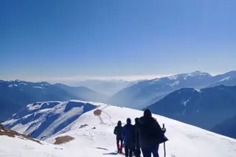
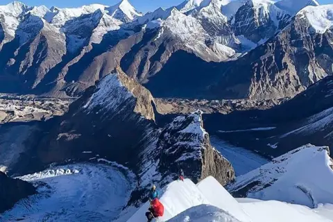
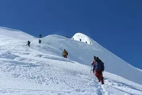
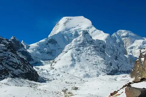
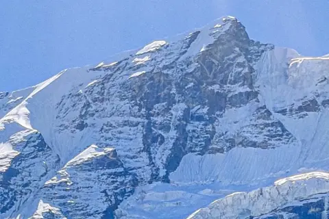
Climb Satopanth Peak at 7,075 meters and experience one of the most challenging technical expeditions in the Indian HimalayasTrek through Vasudhara Falls and Satopanth Glacier while witnessing the untouched beauty of the Garhwal Himalayan landscapesTake on a true mountaineering challenge that demands excellent fitness endurance technical climbing and glacier navigation skillsPlan your Satopanth Expedition in pre-monsoon or post-monsoon seasons to enjoy stable weather and clear breathtaking viewsExplore a spiritually charged environment where natural beauty and mythological significance blend in perfect high-altitude harmonyIdeal for experienced climbers looking for a remote high-altitude adventure that tests physical strength and mental resilienceCapture mesmerizing sunrise and sunset views from the high camps while crossing crevassed glaciers and steep icy slopesNavigate through breathtaking alpine meadows hidden valleys and remote glaciers that offer pristine untouched Himalayan beautySatopanth Expedition is a perfect combination of adventure technical skill spiritual connection and natural Himalayan wondersExperience fewer crowds compared to other Himalayan expeditions offering a true sense of solitude and connection with natureWitness rare Himalayan wildlife unique flora and spectacular glacial formations during the thrilling ascent to Satopanth PeakBuild unmatched endurance and mental toughness while facing challenging terrains long summit pushes and extreme high-altitude cold
Satopanth Trek: Overview
Activity Location: Chamoli, UttarakhandTrip Duration: 21 Days | 20 NightsBest Time to Visit: May, June, September, and OctoberTrekking Distance: 80-90 KMMax. Altitude: 7,075 meters (23,212 feet)Satopanth Trek Difficulty Level: Difficult to ChallengingMeals: Vegetarian mealsAccommodation: Camping Tent (Triple/Quad Sharing)About Satopanth Trek, Uttarakhand.The Satopanth Trek is an exhilarating journey to one of Uttarakhand's most challenging and revered peaks, Satopanth (7,075 meters), nestled in the Garhwal Himalayas. Known for its spiritual significance and technical difficulty, the Satopanth Expedition is a dream climb for seasoned mountaineers seeking a high-altitude adventure in the Indian Himalayas. Starting from the holy town of Badrinath, the route takes climbers through the enchanting Vasudhara Falls, pristine glacial basins, and the formidable Satopanth Glacier. The expedition combines rugged terrains, crevassed glaciers, and steep ice slopes, making it a demanding yet advantageous experience for high-altitude enthusiasts.Unlike many Himalayan treks, the Satopanth Expedition requires technical climbing skills, proper acclimatisation, and a high level of physical fitness. The peak is a true test of endurance, perseverance, and mountaineering expertise. Due to its remote location and harsh weather conditions, the best time to undertake the Satopanth Expedition is during the pre-monsoon (May–June) or post-monsoon (September–October) seasons. The journey is not just about reaching the summit; it's also about immersing oneself in the spiritual aura of the region, where mythological legends and breathtaking landscapes converge. For adventure seekers looking to push their limits while experiencing the raw beauty of the Himalayas, the Satopanth Trek offers an unmatched expeditionary experience. Discover serene beauty on our Kanasar Lake Trek.This Package Includes:Transportation From Dehradun to DehradunTrekkingExperienced & Certified trek leader and local support staffFirst AidAll Meals (breakfast, packed lunch, tea, coffee, snacks, soup and dinner)AccommodationDining Tent, Dining TableHigh-quality Dome tents, sleeping bagsAll Permits And Passes Wherever RequiredMedical Kit, Oxygen CylindersGaiters, Koflach Climbing shoes CramponsIce Axe, Screw gate, Carabineers, rock pitons, ice pitons, snow stakesRescue Ropes, Climbing Ropes, Snow bar, Harness, Descended, Ascender, figure of 8, Ice ScrewRadio Willkie Talkie for CommunicationExcludes:Trekking Gear Personal equipmentAny additional activities or services not included in the itineraryMeal During Road JourneyPotters Or Mules to Carry Personal LuggageAnything not mentioned in the includesTrekker, carry your Photo ID, Adhar card , Passport , Visa , Medical certificate , Declaration from for entry at forest check posts on the trek it is very important.Trending Packages: Deoban Trek |Panwali Kantha Trek |Nachiketa Tal Trek |Nalgan Pass Trek |Mukta Top Trek
Tour Plan
Journey to Gangotri
Pick up to you from Dehradun railway station – Drive to Gangotri – 258 km) (10/11 Hours) (3415 MeterPick up from Dehradun Railway Station early in the morning for the start of your Satopanth Expedition journeyEnjoy a long scenic drive covering approximately 258 kilometers through the picturesque landscapes of UttarakhandWitness beautiful rivers dense forests small towns and traditional Himalayan villages along the winding mountain roadsDrive duration is around 10 to 11 hours with multiple short breaks for refreshments and sightseeing en routeReach Gangotri a sacred town situated at an altitude of 3415 meters and known for the revered Gangotri TempleCheck-in at a guesthouse or camp relax and acclimatize to the high altitude in preparation for the upcoming trekAttend a team briefing session where guides share important details about the expedition and safety instructions
Gangotri Rest & Prep
Rest day + AcclimatizationSpend the day at Gangotri to allow your body to adapt properly to the high-altitude environment before ascending furtherGo for light walks around Gangotri to boost acclimatization while enjoying views of the Bhagirathi River and surrounding peaksVisit the sacred Gangotri Temple and explore nearby attractions to experience the spiritual essence of this Himalayan townStay active but avoid any strenuous activities to help your body adjust safely and minimize the risk of altitude sicknessParticipate in team activities including basic climbing gear checks and short acclimatization hikes in the surrounding areaUse this day to double-check personal gear packs ensure hydration and mentally prepare for the start of the real trekRest well in your guesthouse or campsite and enjoy warm meals to build energy reserves for the upcoming trekking days
Gangotri to Bhojbasa Trek
Trek from Gangotri to Bhojbasa camp (14 km) (6/7 Hours) (3775 Meter).Begin your first day of trekking with an early start from Gangotri following the well-laid trail alongside the Bhagirathi RiverCover approximately 14 kilometers during the trek enjoying spectacular views of lush forests rocky trails and towering mountainsTrekking time will take around 6 to 7 hours depending on pace with plenty of scenic spots ideal for rest and photographyPass through Chirbasa a beautiful spot filled with pine trees offering the first panoramic glimpses of the Bhagirathi peaksContinue trekking on gradually ascending trails towards Bhojbasa located at an altitude of 3775 meters above sea levelWitness the landscape shift from dense greenery to more barren and glacial terrain signaling the approach of higher altitudesSettle into the campsite at Bhojbasa and spend the evening relaxing hydrating and preparing for the next stage of the expedition
Bhojbasa to Nandanvan Trek
Trek from Bhojbasa to Nandanvan via Gomukh.Start your day early from Bhojbasa trekking towards Gomukh the sacred snout of the Gangotri Glacier and source of the Ganges RiverCover the gradual trail to Gomukh while enjoying stunning views of the glacier ice walls and the majestic Bhagirathi mountain rangeSpend some time at Gomukh taking in the spiritual and natural beauty before continuing the steep climb towards NandanvanNavigate challenging glacial moraines loose rocks and steep ascents while crossing rugged and icy terrain on the way to NandanvanGain significant altitude today reaching Nandanvan situated at 4337 meters offering breathtaking views of Shivling Meru and Bhagirathi peaksTrekking from Bhojbasa to Nandanvan takes moderate to strenuous effort but rewards you with some of the best Himalayan landscapesSet up camp at Nandanvan and spend the evening acclimatizing exploring the surroundings and resting for the next day’s trek
Acclimatization Day at Nandanvan
Acclimatization Day at Nandanvan.Spend the day at Nandanvan to help your body adjust to the higher altitude before moving further up towards Satopanth Base CampTake short acclimatization hikes around Nandanvan offering close-up views of towering peaks like Shivling Meru and Bhagirathi groupEngage in light activities to maintain circulation without overexerting the body while staying well hydrated throughout the dayAttend briefing sessions with guides on glacier navigation rope techniques and high-altitude safety protocols for the expeditionUse this important rest day to inspect and organize your mountaineering gear and get mentally prepared for the tougher days aheadCapture stunning photographs of the vast open meadows glaciers and surrounding Himalayan giants under the clear blue skiesRelax at camp enjoy warm meals and ensure you get enough rest to build strength for the upcoming technical climbs
Nandanvan to Vasuki Tal
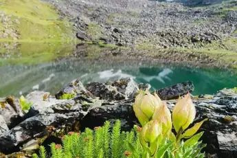
Trek from Nandanvan to Vasuki Tal (Base Camp).Begin the trek from Nandanvan towards Vasuki Tal Base Camp gaining considerable altitude as the terrain becomes more rugged and demandingCross rocky sections and glacial moraines while navigating steep ascents that require careful footing and slow steady climbingTrek distance is moderate but the thin air and technical trail make this stretch physically challenging and mentally engagingWitness incredible views of Mount Shivling and the Bhagirathi massif along with the expanding glacier fields as you gain elevationReach Vasuki Tal located at an altitude of 4898 meters a pristine glacial lake surrounded by raw and breathtaking Himalayan beautySet up the expedition base camp near Vasuki Tal where you will prepare for higher technical sections and summit push strategiesSpend the evening resting hydrating and adjusting to the thinner air while soaking in the surreal beauty of the alpine surroundings
Acclimatization at Vasuki Tal
Acclimatization Day at Vasuki Tal (Base Camp).Spend the day at Vasuki Tal Base Camp focusing on acclimatization to adapt your body to the high-altitude environment of 4898 metersParticipate in short acclimatization hikes around the base camp to improve oxygen efficiency without putting strain on the bodyAttend detailed training sessions on rope handling crampon use glacier travel and safety measures for the summit approachInspect and organize all technical gear such as ice axes harnesses helmets and boots to ensure readiness for the upcoming climbsEnjoy breathtaking views of towering Himalayan peaks shimmering glaciers and the crystal-clear waters of Vasuki Tal LakeMaintain hydration and a balanced diet throughout the day to support your body’s adaptation and build stamina for summit dayRest properly and mentally prepare for the challenging ascent days ahead while staying alert to any signs of altitude sickness
Climb to Advance Base Camp
Trek from Vasuki Tal (Base Camp) to Advance Base Camp (ABC).Begin the day with a steady and challenging climb from Vasuki Tal Base Camp towards the Advance Base Camp situated at 5130 metersTrek over rugged terrain navigating through loose rocks snow patches and gradual inclines that require focus and proper pacingExperience increasingly harsher conditions with thinning air colder temperatures and more technical sections along the routeTake regular breaks to maintain energy levels while enjoying panoramic views of towering Himalayan giants and expansive glaciersReach Advance Base Camp strategically located to launch the summit attempt with breathtaking surroundings and stark glacial beautySet up tents and prepare the camp for the upcoming summit push with safety briefings gear checks and final acclimatization walksRest well hydrate thoroughly and mentally prepare for the next critical stages of the Satopanth Expedition
ABC Acclimatization Day
Acclimatization Day at Advance Base Camp (ABC).Spend the entire day at Advance Base Camp focusing on high-altitude acclimatization to prepare for the technical summit climbTake short rotation hikes to higher elevations above ABC and descend back to camp helping the body adapt to extreme altitudesEngage in technical training sessions including ice axe practice rope fixing crampon walking and crevasse rescue techniquesInspect and test all essential mountaineering gear ensuring everything is in perfect condition before the summit attemptMonitor physical health and oxygen levels carefully while maintaining hydration nutrition and overall body strengthEnjoy the magnificent views of sharp peaks glaciers and endless snowfields that surround the high-altitude Advance Base CampRest deeply and conserve energy as the next few days will involve intense climbing phases leading towards the Satopanth summit
Ferry to Camp 1 for Summit Prep
Load Ferry from Advance Base Camp to Camp 1.Begin the day with a crucial load ferry from Advance Base Camp carrying essential gear equipment and supplies towards Camp 1Trek over challenging and technical terrain involving steep snow slopes loose rocks and crevassed glacier sections requiring cautionCarefully transport loads needed for the summit attempt while progressively acclimatizing by gaining and losing altitude during the ferryCross high-altitude obstacles while getting familiar with the route conditions between Advance Base Camp and Camp 1After reaching Camp 1 deposit loads at the campsite before returning to Advance Base Camp for proper rest and acclimatizationThis load ferry method helps in better acclimatization while preparing the camps higher up for a smoother summit strategySpend the evening back at Advance Base Camp resting rehydrating and preparing mentally for the upcoming move to Camp 1
Trekking to Camp 1 Base
Trek from Advance Base Camp to Camp 1 (5800 m).Begin the ascent from Advance Base Camp towards Camp 1, situated at an altitude of 5800 meters, marking an important stage in the expeditionNavigate through technical and steep terrain including snow fields, crevasses, and rocky patches that require focus and skillful mountaineering techniquesExpect slow, steady progress due to the thin air and physical strain at these altitudes, taking regular breaks for hydration and energy replenishmentReach Camp 1, carefully set up the camp, and ensure that all climbing gear is organized and ready for the summit attemptEnjoy panoramic views of the surrounding glaciers and Himalayan peaks while adjusting to the high-altitude conditionsRest at Camp 1 and conserve energy for the upcoming summit climb, focusing on mental preparation and physical recoveryMaintain a strict regimen of hydration, high-energy meals, and oxygen monitoring to ensure optimal physical condition for the final push
Load Ferry to Camp 2
Load Ferry from Camp 1 to Camp 2.Start the day early with a load ferry from Camp 1 to Camp 2, ensuring all necessary supplies and equipment are moved up to the next camp at higher altitudeNavigate through challenging and steep glacial terrain, including ice slopes and snow-covered paths, requiring careful technique and focusTransport loads slowly and steadily, ensuring that both climbers and gear are well-prepared for the higher elevations and physical demandsReach Camp 2, located at a higher altitude, and set up the necessary gear and provisions for the summit attempt in the coming daysAfter unloading the supplies at Camp 2, carefully descend back to Camp 1 to rest and acclimatize before the final ascent to Camp 2This load ferry helps in acclimatization and prepares the camps for the final summit push, easing the burden on the expedition teamSpend the evening back at Camp 1, ensuring proper hydration, nutrition, and rest, preparing mentally for the next phase of the climb
Ascent to 6200m Camp
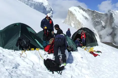
Trek from Camp 1 to Camp 2 (Summit Camp) (6200 m).Begin the day early, ascending from Camp 1 towards Camp 2 (Summit Camp) situated at 6200 meters, marking one of the highest points on the expeditionNavigate through challenging high-altitude terrain with steep inclines, icy slopes, and narrow ridges, requiring expert mountaineering skills and cautionThe trek involves slow and steady progress, taking regular breaks for hydration, oxygen levels, and rest to prevent exhaustion at these extreme altitudesReach Camp 2 (Summit Camp) at 6200 meters, the last camp before the summit, where you'll prepare for the final push to the top of SatopanthSet up camp, organize gear, and rest thoroughly to conserve energy for the summit attempt, ensuring all technical equipment is in placeEnjoy magnificent views of surrounding peaks, glaciers, and vast snowfields, while also adjusting to the high-altitude conditions of Summit CampSpend the night at Camp 2, ensuring hydration, proper nutrition, and mental focus for the final summit attempt the following day
Summit Push to Satopanth
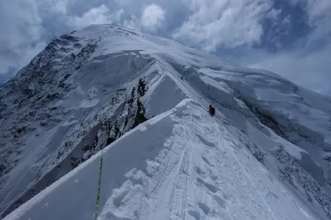
Summit Push from Camp 2 (6200 m) to Satopanth Summit (7075 m) and Return to Camp 2.Begin the summit push early in the morning, leaving Camp 2 (Summit Camp) at 6200 meters to conquer the final ascent to the top of Satopanth (7075 meters)Navigate steep and technical terrain, including ice walls, snow slopes, and rock sections that require advanced climbing techniques and careful navigationThe ascent will be slow and steady due to the thin air and extreme altitude, with regular stops for hydration and oxygen monitoring to maintain staminaReach the summit of Satopanth at 7075 meters, where you’ll be rewarded with breathtaking panoramic views of the Garhwal Himalayas and surrounding peaksAfter spending some time on the summit, take in the extraordinary scenery, and capture memorable photographs, begin your descent back to Camp 2Descend carefully, retracing your steps through challenging terrain and ensuring safety while conserving energyArrive back at Camp 2 (6200 meters) for a well-deserved rest, reflect on your achievement, and celebrate the successful summit of Satopanth
Reserve Day at Camp 2
Reserve Day for Summit.Utilize this reserve day in case additional time is needed for the summit attempt due to weather conditions or other unforeseen circumstancesSpend the day resting at Camp 2 (6200 meters) and recovering from the summit push, while keeping your gear and supplies ready for any potential summit reconnectionIn case of delays or the need for extra acclimatization, use the day to conduct light activities such as gear checks or short walks around the camp to aid recoveryMonitor weather conditions carefully, as weather can greatly affect the summit window, ensuring you're prepared for the next attempt if neededThis extra day offers flexibility, providing time for physical and mental recovery and boosting your chances of a successful summitSpend the evening reflecting on the journey thus far, resting and conserving energy for your next move, whether it be a second summit attempt or beginning the descent
Camp 2 to Camp 1 Descent
Descend from Camp 2 to Camp 1.Begin the descent early in the morning from Camp 2 (6200 meters) down to Camp 1 (5800 meters) after a successful summit or reserve dayCarefully navigate the challenging terrain, crossing glaciers, steep slopes, and rocky sections, which require attention even during the descentThe thin air at high altitudes can still affect your energy levels, so take regular breaks to ensure hydration and recovery as you move lowerReach Camp 1, set up your tents, and rest after a challenging day of descending, while adjusting to the lower altitudeReflect on your accomplishments, rest, and recover from the summit push, preparing for the next descent stages towards Base CampSpend the evening at Camp 1, conserving energy and preparing for the next day's descent to the Advance Base Camp
Return to Advance Base Camp
Descend from Camp 1 to Base Camp and Continue to Advance Base Camp (ABC).Begin your descent early from Camp 1 (5800 meters) towards Base Camp, carefully navigating through snow slopes, rocky patches, and crevassesReach Base Camp, take a short break to rest and hydrate, then continue the journey towards Advance Base Camp (ABC) for further acclimatization and restThe descent will be easier as you move to lower altitudes, but still requires focus on safety and careful navigation of the challenging terrainArrive at Advance Base Camp (5130 meters), set up camp, and rest after the long day of descending and moving between campsTake time to reflect on the successful summit, regain energy, and ensure your gear and supplies are properly organized for the remaining days of the trekSpend the evening at Advance Base Camp, relaxing and conserving strength for the final stages of your descent
Return to Nandanvan
Descend from Vasuki Tal to Nandanvan.Begin the descent from Vasuki Tal (4898 meters) back towards Nandanvan, navigating through the glacial moraines, rocky sections, and snow-covered pathsThe trail offers a mix of gradual descents and rugged terrain, making it important to stay alert while enjoying the stunning scenery of the surrounding peaksTake breaks along the way to hydrate and rest, allowing your body to recover from the high-altitude journey and adjust to the lower elevationsArrive at Nandanvan, a scenic location offering spectacular views of surrounding mountains, and set up camp for the nightReflect on your expedition achievements while resting and rehydrating in preparation for the next phase of your descentSpend the evening at Nandanvan, ensuring all gear is packed and ready for the journey back to lower altitudes
Return to Chirbasa
Descend from Nandanvan to Chirbasa.Start your descent from Nandanvan, heading towards Chirbasa, following the familiar trail that takes you through rocky paths and forested areasThe trail gradually descends, offering easier terrain compared to the higher altitudes, while still requiring attention to footing, especially in snow-covered sectionsEnjoy the beautiful landscapes as you pass through alpine meadows, dense forests, and river streams, gradually transitioning to lower altitudesTake regular breaks to hydrate, rest, and soak in the surroundings as you move towards Chirbasa, a serene spot with lush pine treesArrive at Chirbasa, a peaceful and picturesque camping spot situated along the river, and set up camp for the nightSpend the evening relaxing, reflecting on the journey, and preparing for the final leg of the descent towards Gangotri
Gangotri to Uttarkashi Journey
Descend from Chirbasa to Gangotri and Continue to Uttarkashi.Begin the final leg of your trek, descending from Chirbasa towards Gangotri, following the well-trodden path along the river and through dense forested areasEnjoy the scenic views of the Bhagirathi peaks as you gradually make your way down to Gangotri, where the air becomes thicker and the surroundings more lushArrive at Gangotri, a spiritual destination and the starting point of your trek, where you can take some time to reflect on the successful completion of the expeditionAfter a brief rest and celebration in Gangotri, take a vehicle transfer towards Uttarkashi, located around 100 kilometers away from GangotriEnjoy the scenic drive through the mountains and rivers, taking in the beauty of the lower Himalayan ranges as you make your way to UttarkashiReach Uttarkashi, where you can rest, celebrate the completion of your adventure, and prepare for your onward journey back
Final Drive to Dehradun
Drive from Uttarkashi to Dehradun.Begin the final leg of your journey with a drive from Uttarkashi back to Dehradun, taking in the beautiful landscapes of the Garhwal Himalayas one last timeThe drive typically takes about 8-9 hours, passing through winding mountain roads, river valleys, and scenic villages, offering a tranquil yet reflective end to your journeyEnjoy the view of the mighty Ganges River as it flows through the region, and relax during the descent to the foothills of the HimalayasArrive in Dehradun, where you can rest, freshen up, and reflect on the incredible experience of completing the Satopanth ExpeditionThe journey concludes, and you now have the opportunity to share your stories and memories of the trek, having achieved an incredible mountaineering feat
Package Variant Options
Satopanth Trek With Transportation
Pickup Points
Dropping Points
Dehradun
Things to Carry
ClothingTrekking Shoes: Sturdy, waterproof hiking boots with good grip.Warm Clothing: Thermal layers, fleece jackets, and a waterproof jacket.Trekking Pants: Quick-dry pants or cargo pants.T-shirts: Moisture-wicking T-shirts for comfort.Warm Hat and Gloves: For protection against cold.Socks: Wool or synthetic hiking socks (avoid cotton).Trekking GearBackpack: Comfortable daypack to carry essentials.Trekking Poles: Helpful for stability on steep trails.Rain Cover: For your backpack in case of rain.HydrationWater Bottles: Reusable water bottles or hydration bladder.Water Purification Tablets: For treating water from streams.Health and SafetyFirst Aid Kit: Basic first aid supplies, including antiseptics and band-aids.Personal Medications: Any prescription medications you require.Sunscreen: High SPF to protect against UV rays.Lip Balm: With SPF protection.MiscellaneousCamera: To capture the stunning landscapes.Multi-tool/Swiss Army Knife: For various uses.Headlamp/Flashlight: With extra batteries for nighttime.Toiletries: Biodegradable soap, toothbrush, toothpaste, toilet paper.Trash Bags: To carry back any waste.Mandatory Documents:Original and photocopy of government photo identity card- (Aadhar Card, Driving License, Voters ID, etc,Passport and Visa important to foreignersMedical Certificate (First part should be filled by the Doctor and Second part by the Trekker)Declaration Certificates
Starting from INR 499998
Per Person
( Inclusive of all taxes )
Enquiry Form
Why escape2explore
done Verified Google Reviews 5000+ Reviews on the google platform.done 500+ Tours and Activities We have activities across every category so that you never miss best things to do anywhere.done Customer Delight We are always able to support you so that you have a hassle free experience.
Related Packages
Frequently Asked Questions
Q1: Where is the Satopanth Expedition located?
The Satopanth Expedition takes you deep into the Garhwal Himalayas of Uttarakhand, India. Mount Satopanth stands tall at 7,075 meters, offering a rare opportunity to climb a revered peak near Gangotri Glacier, surrounded by awe-inspiring giants like Bhagirathi and Shivling.
Q2: How difficult is the Satopanth Expedition?
The Satopanth Expedition is considered a technically demanding climb suited for experienced mountaineers. The route includes glacier traverses, crevasse navigation, and steep snow slopes. Climbers must be comfortable with ice axe and crampon use, and should have experience at high altitudes above 6,000 meters.
Q3: What is the best time for the Satopanth Expedition?
May to June and September to early October are the prime windows for the Satopanth Expedition. These periods offer stable weather conditions, clear skies, and safer climbing environments. Post-monsoon climbs also promise crisper views and better snowpack stability compared to spring.
Q4: How many days are needed for the Satopanth Expedition?
The Satopanth Expedition usually spans 21 days. This duration includes acclimatization days, load ferry days, technical training at base camps, summit push, and reserve days in case of bad weather. Proper acclimatization is critical to ensure a successful and safe climb.
Q5: What are the main highlights of the Satopanth Expedition?
Besides the thrill of summiting a 7,000m peak, Satopanth offers magnificent glacier walks, views of Shivling, Bhagirathi Peaks, and the entire Gangotri region. The spiritual significance of the area and the feeling of solitude at high camps add layers to the overall experience.
Q6: Is the Satopanth Expedition safe for first-time climbers?
No, the Satopanth Expedition is not recommended for first-timers. Climbers must have previous high-altitude and basic mountaineering experience. Knowledge of roped glacier travel, crevasse rescue, and using technical gear is essential to ensure both personal and team safety on the expedition.
Q7: What type of accommodation is provided during the Satopanth Expedition?
Expedition members stay in hotels or lodges during the approach trek days, and shift to high-quality expedition tents beyond base camp. Tents are typically twin-shared, equipped with thick sleeping mats, and capable of handling extreme weather at the higher altitudes.
Q8: What should I pack for the Satopanth Expedition?
Packing for Satopanth involves technical mountaineering gear like climbing boots, crampons, harness, helmet, ice axe, and layered clothing for -20°C temperatures. A 90-liter backpack, down jacket, heavy gloves, UV sunglasses, and high-altitude medicines are essentials for comfort and survival.
Q9: Is there mobile connectivity on the Satopanth Expedition?
Mobile network connectivity is very limited. Some signal might be available until Gangotri or Bhojbasa, but beyond that, it’s a complete blackout. Expedition teams often carry satellite phones or walkie-talkies for emergency communication between camps.
Q10: What is the maximum altitude reached during the Satopanth Expedition?
The summit of Mount Satopanth stands at an impressive 7,075 meters (23,212 feet). Reaching this altitude requires not just physical stamina but mental toughness to deal with thin air, biting cold, and long summit push days lasting 10–14 hours.
Q11: Are there water sources available during the climb?
Water is primarily sourced by melting snow beyond base camp. During the trek to base camp, fresh streams and glacier melt provide drinking water. Trekkers and climbers should carry purification tablets and stay hydrated to avoid high-altitude dehydration, which is a silent threat.
Q12: I am a solo traveller, can I join the Satopanth Expedition?
Yes, you can join the trek to Satopanth Expedition. The trip’s difficulty level is moderate and can be attained without someone’s support. Wear robust footwear, and comfortable clothes, and maintain basic fitness to complete the trek.
Q13: Satopanth Expedition is safe for females?
The safety and security of women/girls are paramount to us. Hence, it's entirely safe for women/girls to participate in our treks and travels. Our trip leaders always accompany the group, offering constant assistance and direction. Our campsites are thoroughly secure and provide a safe lodging environment. In addition, our female trip leaders often join our trips.
Q14: What will happen if the Satopanth Expedition does not go through?
Your money will be refunded within 21 business days.
Q15: Can I reschedule my Satopanth Expedition to a future date if I am unable to attend on the day of departure?
Unfortunately, it's not feasible to reschedule your tour to a future date if you're unable to attend on the designated day, regardless of the circumstances (like family emergencies, health problems, or work commitments). However, if you have concerns about this policy, please don't hesitate to email us at info@escape2explore.com, and our team will get in touch with you to discuss further.
Cancellation Policy
Life is unpredictable and we understand that sometimes you have to cancel or change your trip dates and we endeavour to make it as easy as possible for you. However, please understand that we plan everything including guide fees, permits, accommodation and rations in advance. Therefore, any cancellation means inconvenience and certain losses to the people involved in various stages of the programme. Keeping that in mind, our cancellation charges are as below -Cancellations before 30 days from the start of the event: Get a monetary refund with 15% of cancellation charges.Cancellations between 30 days and 15 days to the start of the event: 50 %refund.Cancellations less than 15 days to the start of the event: No refund.Cancellations will be accepted only by email.Note: The Himalayan Daredevils reserves the right to cancel a program before departure in the event of logistical problems arising due to natural calamities, strikes, wars or any other circumstances that make the event inadvisable. In this case, we will refund 50% of the event fees.Itinerary Changes &Trip delays:We plan itineraries based on the information available at the time of planning and in rare circumstances, they are subject to change. If the itinerary is changed or delayed due to unforeseen circumstances such as bad weather, transportation delays, government intervention, landslides etc., we will always aim to give you the best experience possible. However, The Himalayan Daredevils not be held responsible for the cost of delay or changes.For Bookings made from Third Party Websites:The client is responsible for communicating with a third party (booking website) for cancellation.Cancellation / Refund is done by a third party based on their policies.
Blog - Satopanth Trek: A Quick Guide
The Satopanth Trek is also the divine abode of Vishnu, besides being the spiritual center of the Garhwal Himalayas in Uttarakhand. The trek, which takes you to the holy Satopanth Lake at around 4,600 m (15,100 ft), is near the yet another sacred place - Badrinath. The lake is surrounded by the likes of Neelkanth, Satopanth, Chaukhamaba, and Balakun, and is mentioned in Hindu mythology as a very holy place. It is said that the triangular lake represents the Hindu Trinity: Brahma, Vishnu, and Mahesh (Shiva), who are supposed to have done their meditation there. The Satopanth journey provides a wonderful blend of spirituality, thrill, and natural charm. Starting from Mana village, the last village nearest to the Indo-Tibet border, the trek passes through enchanting landscapes which include green meadows, rocky moraines, ice paths, and sparkling streams. People on the trek also have to cross places of equal importance, like Laxmi Van and Chakratirtha, each having their own mythological stories and magnificent views.Satopanth is quite an offbeat trek as compared to commercial ones and it is this that has made its purity and charm gain greater heights. Walkers will be able to see the beautiful mountain flora and fauna along the way, have a very peaceful time in their camps, and the great mountains of the Himalayas will be there to look at the whole time. The trek is moderate to difficult, and it is for experienced trekkers who would like to have both the trek alone and a better connection with nature and the mythology. Moreover, Satopanth climbs are also very popular among enthusiastic people and photographers who cannot resist the mesmerising lake side an , reflections of the snow-covered mountains in the deep blue-green lake waters. Standing at the lake side, Satopanth is nothing but absolute tranquillity lake side, and divinity. Rather than just an adventure, this is more like a journey of the soul, a beautiful combination of mythology, pure nature from the Himalayas, and an endurance test.History of Satopanth TrekThe Satopanth Trek past is the Satopanth Trek past is associated with Satopanth Trek is associated with Hindu mythology and spiritual beliefs, which in Satopanth Trek is one of the most Satopanth Trek is one of the most Satopanth Trek is one of the most Satopanth Trek is one of the most "Satopanth" means the "Path The Satopanth Trek past is associated with mythology and spiritual beliefs, which make the trek one of the most Satopanth Trek is one of the most Satopanth Trek is one of the most revered high-altitude treks in India. The name "Satopanth" itself means "Path of Truth" or "Path of Holiness," indicating the spiritual meaning connected to the trip. One story from the past tells that Satopanth Lake is directly connected with the Mahabharata, one of the greatest epics of India. It is said that the five Pandava brothers, after the war of Kurukshetra, decided to go for a spiritual pilgrimage in the Himalayas. This journey is called the Swargarohini Yatra (the ascent to heaven) nowadays. They passed by Badrinath on their way to Satopanth Lake and then took off to Swargarohini Peak.According to the local myths, it is Dharma Raja Yudhishthira, the eldest Pandava, interpenetrated with his dog, an incarnation of Lord Dharma himself, who flew away into heaven from here. For that reason, Satopanth is the place where they were leaving for heaven of the heavenly sky above. It is considered that the lake The lake is also regarded as the one representing the Hindu Trinity Brahma (the Creator), Vishnu (the Preserver), and Shiva (the Destroyer). Ancient priests and sages have the view that these Gods meditate at the lake after coming down on dignified days. This amusement turned Satopanth Lake into one of the earliest pilgrimage sites of saints, besides contemporary spiritual seekers. The vicinity perished with the glory of the myth as well, that is, Laxmi Van and Chakratirtha. Laxmi Van is said to be the one that Goddess Laxmi has blessed, while Chakratirtha relates to Lord Vishnu’s Sudarshana Chakra.Today, too, it is known that there are still a few such isolated places where some hermits and scholars practice the art of meditation in caves at the periphery of the trail, making the area even more mysterious. Mythology aside, this area still holds some major historical importance because of its age-old pilgrimage routes. Mana village is the base of the trek that is considered the Indian village “last” and has cultural links through Tibet and ancient trade routes. Over the last few hundred years, explorers, trekkers, and mountaineers have grown fascinated by the Satopanth region and have been drawn to it because of its combination of myth and majesty. The lake will always be a symbol of faith for pilgrims and, at the same time, a marvel of the Garhwal Himalayas for adventure lovers. Hence, the history of Satopanth Trek is not just about the lake and the trail, it is a living blend of mythology, spirituality, ancient pilgrimage, and Himalayan grandeur. Not only that, but for today's trekkers, walking along the path of Satopanth is almost the same as going back in time and following the steps the gods, the sages, and the heroes of the epics took thousands of years ago.Nearby Places around Satopanth TrekBadrinath Temple: Being one of the most sacred shrines of the Char Dham Yatra, Badrinath temple, is dedicated to Lord Vishnu. This shrine located at an elevation of 3,133 meters is the spiritual core of the hundreds of thousands of pilgrims who make a year journey here. It usually becomes a holy start to the trek Satopanth for trekkers, and the visit to this ancient temple also makes the pilgrimage divine.Mana Village: Mana is famous as the last inhabited village of India close to the Indo-Tibet border and is rich in myths and culture. It is connected with the Mahabharata, where the Pandavas are considered to have started their heavenward journey. Apart from this, the place has Bhim Pul, Vyas Gufa, and Ganesh Gufa, which are also very old and unique places of the past.Vasudhara Falls: Situated about 9 km away, Vasudhara Falls, is an astonishing natural marvel of a plunge of 400 feet. Encompassed by peaks covered with snow, the falls are considered to have a spiritual meaning too-local talk says only the pure-hearted can see the waterfall with all its beauty.Laxmi Van: The Laxmi Van is a patch of deep forest on the Satopanth trail that is considered to be the area blessed by the Goddess Laxmi. The place is filled with alpine trees and also offers a beautiful camping site. The peaceful atmosphere, along with the mythological stories, makes it a very important stop going along the trek.Chakratirtha: A beautiful valley surrounded by glaciers and mountains, Chakratirtha is the other place where the trek takes a break. According to the story, this is the place where Lord Vishnu threw his Sudarshana Chakra and the rocks there got a circular mark left behind. The combination of the beautiful nature and the mythology makes it both very scenic and religious.Neelkanth Peak: Neelkanth is known as the “Garhwal Queen” and is the lovely peak (6,597 m) that stands high and close to Badrinath. During sunrise, the snow-capped summit emits a golden light, thus making the whole region very beautiful. Trekkers and pilgrims both gain from nature and spirituality when this peak is considered, for it is said to be a manifestation of Lord Shiva.Best Time to Visit Satopanth TrekSummer (May – June): One of the most desirable seasons to go for the Satopanth Trek is summer. During this time, the snow begins to melt; hence, the trekking trails are open and they are covered with flowers, trees, and streams that are all visible because they are very clean. The weather during the day is usually pleasant, and the temperature may vary from 10° to 15° centigrade. Besides that, the night can be quite cold. Most of the time, the sky is clear, and as a result, trekkers can have a stunning view of the peaks like Neelkanth, Chaukhamba, and Balakun. The crowd of holy people who are visiting Badrinath is also a great addition to the spiritual energy of the trip.Monsoon (July – September): Rains are very heavy during the monsoon and as a result, most of the paths become slippery and wet, which is very dangerous for trekking. Therefore, trekking during this time is really challenging. The nature, however, for those who dare, looks very beautiful, and the water falling from the mountains can be heard loudly while the surroundings look as if from a fairy tale. The weather during this season is highly unpredictable and thus, most trekkers prefer to stay away from it. Nevertheless, the last week of the monsoon may have some days with sun and less chances of rain, therefore some might consider it to be a safe period for trekking.Autumn (Mid-September – October): Satopanth Trek is best done in the autumn season. Right after the monsoon season, the sky is usually very clear and the nature is fresh and beautiful, which is why the panoramic views of the Himalayas are very glorious. In fact, the lake itself looks very clean with the water being of emerald green color that reflects the snow-covered mountains. The weather during the day is not very hot nor very cold and the temperature ranges from 8 degrees to 12 degrees centigrade. However at night, the temperature can go even below zero. This time of the year is really a great opportunity for photographers as well as for the people looking for some spiritual refuge which means that it is perfect for both the pilgrims and the adventurers.Winter (November – April): Satopanth winters are severe with a lot of snow covering all the way, leaving the village and the extensive upper valley inaccessible to normal trekkers. The temperature can get so low that it might even be doubled as it drops under the freezing point of water, and the lake remains frozen. Common trekkers shouldn’t go specialised there in winter except for the ones who are highly experienced and have the specialized equipment for the purpose.How to Reach Satopanth TrekBy Road: Mana Village, located 3 km beyond Badrinath, is the place to start the Satopanth Trek. Badrinath is reachable by car from various big cities in Uttarakhand. There are buses and shared taxis that operate between Haridwar, Rishikesh, Joshimath, and Badrinath at regular intervals. Crews need to take a car and go from Badrinath to Mana for a short time since the trek is there. The trip itself is pretty as it winds through the mountain curves, pinewood forests, and the holy Alaknanda River.By Railway Station: Satopanth Trek, the nearest railway station to which is Haridwar Railway Station, is about 320 km away from Badrinath. Haridwar is connected by train to cities such as Delhi, Dehradun, Lucknow, and Kolkata. One can take a cab, bus, or shared vehicle from Haridwar to Badrinath via Rishikesh and Joshimath. The rail route is recommended to those who live at a considerable distance from the cities and want to reach them by train.By Airport: About 310 km, Jolly Grant Airport, Dehradun, is the closest airport to land in Badrinath. It receives flights from Delhi and other cities and is a hub for a few other regional and international flights. Tourists can take taxis or buses from the airport that will take them to Rishikesh, Joshimath, and finally to Badrinath. Although there is a helicopter allowing a quicker journey from Dehradun to Badrinath during the peak pilgrimage season, one can only use it if the weather is perfect.Why Book with escape2exploreWhen exploring the Satopanth Trek and beyond, escape2explore stands out as a trusted name in adventure and experiential travel. Here’s why hundreds of travellers choose us for their getaways:Trusted, Well-Reviewed Local Operator: escape2explore has gained the trust of thousands of content tourists all over India. With persistent positive feedback and an unblemished reputation for delivering quality experiences, we assure you that your experience will be hassle-free, memorable, and value-packed. Our insider local knowledge guarantees that you will always be in safe hands.Seasoned Guides: Our trips are led by friendly, trained, and professional guides who are passionate about the outdoors and your safety. Whether it's a beach trek, a cultural tour, or a spiritual walk through temples, our team knows the terrain, the stories, and how to make each moment count.Safe & Curated Itineraries: Your safety is our number one priority. Our tour packages are thoughtfully crafted with safety measures, researched accommodations, and easy travel arrangements. We take care of the details so you can have the experience hassle-free and worry-free.Unique Experience That You Won't Find Anywhere Else: With escape2explore, you discover more than the tourist attractions. We go off the beaten track with hidden beaches, unusual treks, offbeat cultural destinations, and true interactions.


